Corona del Mar State Beach
| Corona del Mar State Beach | |
|---|---|

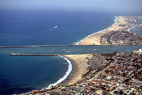
Aerial view of Corona del Mar State Beach (in foreground before the jetty)
|
|
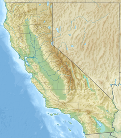
| Location | Orange County, California, United States |
| Nearest city | Newport Beach, California |
| Coordinates | 33°35′37″N 117°52′30″W / 33.59361°N 117.87500°WCoordinates: 33°35′37″N 117°52′30″W / 33.59361°N 117.87500°W |
| Area | 30 acres (12 ha) |
| Established | 1947 |
| Governing body | California Department of Parks and Recreation |
Corona del Mar State Beach (Spanish for the Crown of the Sea) is a protected beach in the state park system of California, United States. It is located in Corona del Mar, Newport Beach, and operated by the city of Newport Beach. The 30-acre (12 ha) park was established in 1947.
The beach had been a surfing hotspot until the late 1930s, when the Newport Harbor jetty was extended, leading to the creation of The Wedge as a popular surf break, but shielding Corona from all but the most southerly swells.
Surfing legend Duke Kahanamoku is credited with the first use of a surfboard for rescue purposes at Corona del Mar beach in 1925, when a charted fishing vessel capsized in heavy surf and Kahanamoku rescued people via surfboard.
...
Wikipedia


