Conneaut, Ohio
| Conneaut, Ohio | |
|---|---|
| City | |

Aerial view of the port at Conneaut
|
|
| Motto: "Ohio's Sharpest Corner" | |
 Location of Conneaut, Ohio |
|
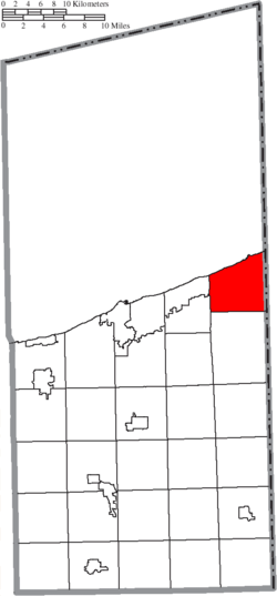
 Location of Conneaut in Ashtabula County |
|
| Coordinates: 41°56′50″N 80°33′20″W / 41.94722°N 80.55556°WCoordinates: 41°56′50″N 80°33′20″W / 41.94722°N 80.55556°W | |
| Country | United States |
| State | Ohio |
| County | Ashtabula |
| Settled | 1799 |
| Incorporated | 1834 (village) 1902 (city) |
| Area | |
| • Total | 26.43 sq mi (68.45 km2) |
| • Land | 26.36 sq mi (68.27 km2) |
| • Water | 0.07 sq mi (0.18 km2) |
| Elevation | 646 ft (197 m) |
| Population (2010) | |
| • Total | 12,841 |
| • Estimate (2012) | 12,879 |
| • Density | 487.1/sq mi (188.1/km2) |
| Time zone | Eastern (EST) (UTC-5) |
| • Summer (DST) | EDT (UTC-4) |
| ZIP code | 44030 |
| Area code(s) | 440 |
| FIPS code | 39-18350 |
| GNIS feature ID | 1077521 |
| Website | www.conneautohio.gov |
Conneaut (/ˈkɒni.ɔːt/;KON-ee-ot) is a city in Ashtabula County, Ohio, United States, along Lake Erie at the mouth of Conneaut Creek. The population was 12,841 at the 2010 Census. Conneaut is located at the far northeastern corner of the state.
Conneaut is located on an old Native American trail, later used by early westbound pioneers. The word conneaut comes from the Seneca language, and has a disputed meaning. A Mississauga village was located at or near Conneaut, c. 1747. Conneaut was originally named Salem, and the parts surrounding it were named "Lakeville" from 1944–1964, though these were eventually combined into what is now known as "Conneaut". People still refer to parts of Conneaut as Lakeville or Amboy.
Conneaut was described in 1833 as having a printing office, one meeting house, two taverns, and several stores and shops.
On March 27, 1953 a three-train collision near Conneaut resulted in the deaths of 21 persons.
Conneaut is located at 41°57′N 80°34′W / 41.950°N 80.567°W (41.9433, -80.5695). According to the United States Census Bureau, the city has a total area of 26.43 square miles (68.45 km2), of which 26.36 square miles (68.27 km2) is land and 0.07 square miles (0.18 km2) is water. Conneaut is situated along Lake Erie at the mouth of Conneaut Creek.
...
Wikipedia
