Commercial Township, New Jersey
| Commercial Township, New Jersey | |
|---|---|
| Township | |
| Township of Commercial | |

|
|
| Motto: Small Town Charm, Along the Scenic Maurice River | |
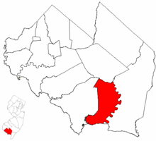
 Commercial Township highlighted in Cumberland County. Inset map: Cumberland County highlighted in the State of New Jersey. |
|
 Census Bureau map of Commercial Township, New Jersey |
|
| Coordinates: 39°16′26″N 75°02′43″W / 39.273751°N 75.045267°WCoordinates: 39°16′26″N 75°02′43″W / 39.273751°N 75.045267°W | |
| Country | |
| State |
|
| County | Cumberland |
| Incorporated | February 27, 1874 |
| Government | |
| • Type | Township |
| • Body | Township Committee |
| • Mayor | Ronald Sutton Sr. (D, term ends December 31, 2016) |
| • Clerk | Hannah E. Nichols |
| Area | |
| • Total | 34.438 sq mi (89.194 km2) |
| • Land | 32.129 sq mi (83.214 km2) |
| • Water | 2.309 sq mi (5.980 km2) 6.70% |
| Area rank | 70th of 566 in state 7th of 14 in county |
| Elevation | 13 ft (4 m) |
| Population (2010 Census) | |
| • Total | 5,178 |
| • Estimate (2015) | 5,080 |
| • Rank | 371st of 566 in state 7th of 14 in county |
| • Density | 161.2/sq mi (62.2/km2) |
| • Density rank | 520th of 566 in state 7th of 14 in county |
| Time zone | Eastern (EST) (UTC-5) |
| • Summer (DST) | Eastern (EDT) (UTC-4) |
| ZIP code | 08349 - Port Norris |
| Area code(s) | 856 |
| FIPS code | 3401114710 |
| GNIS feature ID | 0882062 |
| Website | www |
Commercial Township is a township in Cumberland County, New Jersey, United States. It is part of the Vineland-Millville-Bridgeton Primary Metropolitan Statistical Area for statistical purposes. As of the 2010 United States Census, the township's population was 5,178, reflecting a decline of 81 (-1.5%) from the 5,259 counted in the 2000 Census, which had in turn increased by 233 (+4.6%) from the 5,026 counted in the 1990 Census.
Commercial Township was incorporated as a township by an act of the New Jersey Legislature on February 27, 1874, from portions of Downe Township. The township was named for its shellfish industry.
According to the United States Census Bureau, the township had a total area of 34.438 square miles (89.194 km2), including 32.129 square miles (83.214 km2) of land and 2.309 square miles (5.980 km2) of water (6.70%).
Laurel Lake (2010 Census population of 2,989) and Port Norris (population of 1,377 as of 2010) are unincorporated communities and census-designated places (CDPs) located within Commercial Township.
Other unincorporated communities, localities and place names located partially or completely within the township include Baileytown, Bivalve, Buckshutem, Haleyville, Lores Mill, Mauricetown, North Port Norris and Shell Pile.
...
Wikipedia
