Columbia, Louisiana
| Columbia, Louisiana | |
| Town | |
|
Gateway to Ouachita River at Columbia, Louisiana
|
|
| Nickname: Columbia on the Ouachita | |
| Country | United States |
|---|---|
| State | Louisiana |
| Parish | Caldwell |
| Elevation | 75 ft (22.9 m) |
| Coordinates | 32°06′15″N 92°04′37″W / 32.10417°N 92.07694°WCoordinates: 32°06′15″N 92°04′37″W / 32.10417°N 92.07694°W |
| Area | 0.77 sq mi (1.99 km2) |
| - land | 0.76 sq mi (1.97 km2) |
| - water | 0.01 sq mi (0.03 km2) |
| Population | 390 (2010) |
| Density | 514.9/sq mi (198.8/km2) |
| Founded | 1827 |
| Timezone | CST (UTC-6) |
| - summer (DST) | CDT (UTC-5) |
| Area code | 318 |
|
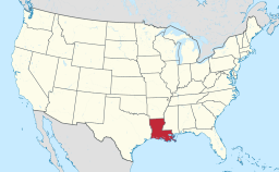
Location in Caldwell Parish and the state of Louisiana.
|
|
Columbia is a town in and the parish seat of Caldwell Parish, Louisiana, United States. The population was 390 as of the 2010 census, down from 477 at the 2000 census.
Columbia is located just east of the center of Caldwell Parish at 32°6′15″N 92°4′37″W / 32.10417°N 92.07694°W (32.104042, -92.076921), on the southwest bank of the Ouachita River. U.S. Route 165 passes through the center of town and bridges the river, leading north 32 miles (51 km) to Monroe and south 64 miles (103 km) to Alexandria.
According to the United States Census Bureau, the town has a total area of 0.77 square miles (2.00 km2), of which 0.76 square miles (1.96 km2) is land and 0.01 square miles (0.03 km2), or 1.75%, is water.
As of the census of 2000, there were 477 people, 184 households, and 101 families residing in the town. The population density was 629.9 people per square mile (242.3/km²). There were 237 housing units at an average density of 312.9 per square mile (120.4/km²). The racial makeup of the town was 70.02% White, 27.25% African American, 0.63% Native American, 1.47% Asian, 0.42% from other races, and 0.21% from two or more races. Hispanic or Latino of any race were 0.42% of the population.
...
Wikipedia


