Colonial National Historical Park
| Colonial National Historical Park | |
|---|---|
|
IUCN category V (protected landscape/seascape)
|
|

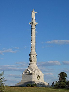
Yorktown Victory Monument, near Yorktown, Virginia
|
|
| Location | York and James City counties and Williamsburg, Virginia, USA |
| Nearest city | Williamsburg, VA |
| Coordinates | 37°13′8″N 76°31′3″W / 37.21889°N 76.51750°WCoordinates: 37°13′8″N 76°31′3″W / 37.21889°N 76.51750°W |
| Area | 9,349.28 acres (37.8352 km2) 9,271.30 acres (3,751.96 ha) federal |
| Established | December 30, 1930 |
| Visitors | 3,335,060 (in 2014) |
| Governing body | National Park Service and Preservation Virginia |
| Website | |
|
Colonial National Historical Park
|
|
| Nearest city | Jamestown, Virginia |
| Built | 1607 |
| Architect | Peterson, Charles; et al. |
| Architectural style | Colonial Revival |
| NRHP Reference # | 66000839 |
| VLR # | 047-0002 |
| Significant dates | |
| Added to NRHP | October 15, 1966 |
| Designated VLR | See individual properties |
Colonial National Historical Park
Colonial National Historical Park is located in the Hampton Roads region of Virginia and is operated by the National Park Service of the United States government. The park protects and interprets several sites relating to the Colony of Virginia and the history of the United States more broadly, ranging from the site of the first landing of the English settlers who would settle at Jamestown, to the battlefields of Yorktown where the British Army was finally defeated in the American Revolutionary War. Over 3 million people visit the park each year.
The park includes the Colonial Parkway, a scenic 23-mile (37 km) parkway linking the three points of Virginia's Historic Triangle: Jamestown and Yorktown and running through the historic district of Colonial Williamsburg. The Colonial Parkway is located in James City County, York County, and the city of Williamsburg.
The park includes the original site of Jamestown known in modern times as Historic Jamestowne. Located in James City County at the southern end of the Colonial Parkway, it encompasses the area of Jamestown Island, including the Jamestown Glasshouse, and is adjacent to the Commonwealth of Virginia's complementary attraction known as Jamestown Settlement.
At the northern end of the Colonial Parkway, in York County at Yorktown, the park operates the Yorktown Battlefield. The Nelson House, which was built around 1724, may have served as Cornwallis’s headquarters during the final battle of the Revolutionary War, and the battlefield was the site of the British defeat. Both the house and the historic siege earthworks were restored in 1976. The Moore House is located in the eastern part of the park and is where surrender negotiations took place in 1781. Nearby, the state-operated Yorktown Victory Center and the Yorktown Riverwalk Landing area are located.
...
Wikipedia


