Colmar Airport
|
Colmar - Houssen Airport Aéroport de Colmar - Houssen |
|||||||||||||||
|---|---|---|---|---|---|---|---|---|---|---|---|---|---|---|---|
 |
|||||||||||||||
| Summary | |||||||||||||||
| Airport type | Public | ||||||||||||||
| Serves | Colmar, France | ||||||||||||||
| Location | Houssen | ||||||||||||||
| Elevation AMSL | 627 ft / 191 m | ||||||||||||||
| Coordinates | 48°06′37″N 007°21′33″E / 48.11028°N 7.35917°ECoordinates: 48°06′37″N 007°21′33″E / 48.11028°N 7.35917°E | ||||||||||||||
| Map | |||||||||||||||
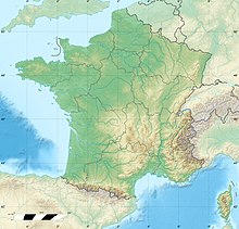
| Location of airport in France | |||||||||||||||
| Runways | |||||||||||||||
|
|||||||||||||||
Colmar - Houssen Airport (French: Aéroport de Colmar - Houssen) (IATA: CMR, ICAO: LFGA) is an airport in Houssen, 1 km (1 mile) north of Colmar, both communes in the Haut-Rhin department of the Alsace region in France. The airport is along Autoroute A35 and is served by the Colmar Station.
The airport resides at an elevation of 627 feet (191 m) above mean sea level. It has one paved runway designated 01/19 which measures 1,610 by 30 metres (5,282 ft × 98 ft) and a parallel grass runway measuring 950 by 80 metres (3,117 ft × 262 ft).
...
Wikipedia

