Cole County, Missouri
| Cole County, Missouri | |
|---|---|

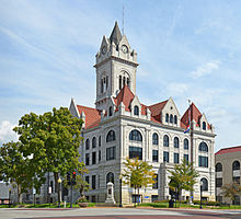
Cole County Courthouse in Jefferson City
|
|
 Location in the U.S. state of Missouri |
|
 Missouri's location in the U.S. |
|
| Founded | 1820 |
| Seat | Jefferson City |
| Largest city | Jefferson City |
| Area | |
| • Total | 402 sq mi (1,041 km2) |
| • Land | 394 sq mi (1,020 km2) |
| • Water | 8.2 sq mi (21 km2), 2.0% |
| Population (est.) | |
| • (2015) | 76,720 |
| • Density | 193/sq mi (75/km²) |
| Congressional district | 3rd |
| Time zone | Central: UTC-6/-5 |
| Website | www |
| Cole County, Missouri | ||||
|---|---|---|---|---|
| Elected countywide officials | ||||
| Assessor | Chris Estes | Republican | ||
| Circuit Clerk | Dawnel P. Davidson | Republican | ||
| County Clerk | Steve Korsmeyer | Republican | ||
| Collector | Larry Vincent | Republican | ||
|
Commissioner (Presiding) |
Sam Bushman | Republican | ||
|
Commissioner (District 1) |
Jeff Hoelscher | Republican | ||
|
Commissioner (District 2) |
Kris Scheperle | Republican | ||
| Coroner | Carl R. Doerhoff | Independent | ||
| Prosecuting Attorney | Mark Richardson | Republican | ||
| Public Administrator | Marilyn Schmutzler | Democratic | ||
| Recorder | Larry D. Rademan | Democratic | ||
| Sheriff | Greg White | Republican | ||
| Treasurer | Eric Peters | Republican | ||
| Cole County, Missouri | ||
|---|---|---|
| 2008 Republican primary in Missouri | ||
| John McCain | 2,982 (28.74%) | |
| Mike Huckabee | 3,247 (31.30%) | |
| Mitt Romney | 3,729 (35.95%) | |
| Ron Paul | 227 (2.19%) | |
| Cole County, Missouri | ||
|---|---|---|
| 2008 Democratic primary in Missouri | ||
| Hillary Clinton | 4,089 (45.07%) | |
| Barack Obama | 4,642 (51.16%) | |
| John Edwards (withdrawn) | 264 (2.91%) | |
Cole County is a county in the central part of the U.S. state of Missouri. As of the 2010 census, the population was 75,990. Its county seat is Jefferson City, the state capital. The county was organized November 16, 1820 and named after pioneer Captain Stephen Cole, an Indian fighter and pioneer settler, who built Cole's Fort in Boonville.
Cole County is in the Jefferson City, MO Metropolitan Statistical Area. It is south of the Missouri River.
In 2010, the center of the population of Missouri was in Cole County, near the village of Wardsville.
According to the U.S. Census Bureau, the county has a total area of 402 square miles (1,040 km2), of which 394 square miles (1,020 km2) is land and 8.2 square miles (21 km2) (2.0%) is water. It is the third-smallest county in Missouri by area.
As of the census of 2000, there were 71,397 people, 27,040 households, and 17,927 families residing in the county. The population density was 182 people per square mile (70/km²). There were 28,915 housing units at an average density of 74 per square mile (29/km²). The racial makeup of the county was 87.06% White, 9.92% Black or African American, 0.33% Native American, 0.88% Asian, 0.04% Pacific Islander, 0.54% from other races, and 1.23% from two or more races. Approximately 1.28% of the population were Hispanic or Latino of any race. 40.1% were of German, 13.6% American, 7.8% English and 6.9% Irish ancestry.
...
Wikipedia
