Colby, KS
| Colby, Kansas | |
|---|---|
| City | |

Thomas County Courthouse (2014)
|
|
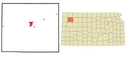
 Location within Thomas County and Kansas |
|
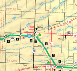
 KDOT map of Thomas County (legend) |
|
| Coordinates: 39°23′32″N 101°2′51″W / 39.39222°N 101.04750°WCoordinates: 39°23′32″N 101°2′51″W / 39.39222°N 101.04750°W | |
| Country | United States |
| State | Kansas |
| County | Thomas |
| Founded | 1885 |
| Incorporated | 1886 |
| Area | |
| • Total | 3.38 sq mi (8.75 km2) |
| • Land | 3.38 sq mi (8.75 km2) |
| • Water | 0 sq mi (0 km2) |
| Elevation | 3,156 ft (963 m) |
| Population (2010) | |
| • Total | 5,387 |
| • Estimate (2016) | 5,419 |
| • Density | 1,600/sq mi (620/km2) |
| Time zone | Central (CST) (UTC-6) |
| • Summer (DST) | CDT (UTC-5) |
| ZIP code | 67701 |
| Area code(s) | 785 |
| FIPS code | 20-14650 |
| GNIS feature ID | 0471203 |
| Website | CityOfColby.com |
Colby is a city in and the county seat of Thomas County, Kansas, United States. As of the 2010 census, the city population was 5,387.
In 1882, a post office was established near the center of Thomas County. Area homesteaders lived under harsh conditions in sod houses, creating demand for a town to provide lumber and other provisions to incoming settlers. J.R. Colby, a local land assessor and preacher, obtained a patent to establish the town in April 1884, and land was acquired for the town site three miles north of the post office in March 1885. The following month, the Kansas Secretary of State issued the Town Charter. Kansas Gov. John Martin named Colby the county seat in 1885, and the city was incorporated in 1886. The Union Pacific Railroad reached the city in 1887, and the Rock Island Railroad followed the next year.
In 1941 the St. Thomas Hospital was built as part of the Works Progress Administration plan to build hospitals. This was one of 130 new hospitals to be built with these funds, it was one of two built in Kansas alone. Within the last couple of years, it was renovated to apartments under the name St. Thomas Historic Residences.
Interstate 70 reached Colby in 1965, stimulating the growth of a local hospitality industry.
Colby is located at 39°23′32″N 101°02′51″W / 39.392093°N 101.047532°W (39.392093, -101.047532) at an elevation of 3,159 feet (963 m). It lies on the south side of Prairie Dog Creek, a tributary of the Republican River, in the High Plains region of the Great Plains. A small tributary of the creek flows northeast through the town. Located at the interchange of Interstate 70 and K-25 in northwestern Kansas, Colby is 212 mi (341 km) east-southeast of Denver, 232 mi (373 km) northwest of Wichita, and 347 mi (558 km) west of Kansas City.
...
Wikipedia
