Coal Grove, Ohio
| Coal Grove, Ohio | |
|---|---|
| Village | |

Twin bridges linking Coal Grove to Ashland
|
|
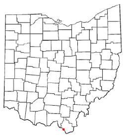
 Location of Coal Grove, Ohio |
|
 Location of Coal Grove in Lawrence County |
|
| Coordinates: 38°30′1″N 82°38′45″W / 38.50028°N 82.64583°WCoordinates: 38°30′1″N 82°38′45″W / 38.50028°N 82.64583°W | |
| Country | United States |
| State | Ohio |
| County | Lawrence |
| Area | |
| • Total | 2.04 sq mi (5.28 km2) |
| • Land | 1.90 sq mi (4.92 km2) |
| • Water | 0.14 sq mi (0.36 km2) |
| Elevation | 577 ft (176 m) |
| Population (2010) | |
| • Total | 2,165 |
| • Estimate (2012) | 2,158 |
| • Density | 1,139.5/sq mi (440.0/km2) |
| Time zone | Eastern (EST) (UTC-5) |
| • Summer (DST) | EDT (UTC-4) |
| ZIP Acode | 45638 |
| Area code(s) | 740 |
| FIPS code | 39-16378 |
| GNIS feature ID | 1075593 |
Coal Grove is a village in Lawrence County, Ohio, United States, along the Ohio River. The population was 2,165 at the 2010 census. It borders the city of Ironton and lies across the Ohio River from Ashland, Kentucky. It is linked to Ashland by the Ben Williamson Memorial Bridge and Simeon Willis Memorial Bridge.
Coal Grove is a part of the Huntington-Ashland, WV-KY-OH, Metropolitan Statistical Area (MSA). As of the 2000 census, the MSA had a population of 288,649.
Coal Grove was once known as "Petersburg" or "Petersburgh." Its name has also been spelled "Coalgrove."
Coal Grove is located at 38°30′1″N 82°38′45″W / 38.50028°N 82.64583°W (38.500240, -82.645926).
According to the United States Census Bureau, the village has a total area of 2.04 square miles (5.28 km2), of which 1.90 square miles (4.92 km2) is land and 0.14 square miles (0.36 km2) is water.
As of the census of 2010, there were 2,165 people, 833 households, and 593 families residing in the village. The population density was 1,139.5 inhabitants per square mile (440.0/km2). There were 891 housing units at an average density of 468.9 per square mile (181.0/km2). The racial makeup of the village was 97.7% White, 0.6% African American, 0.4% Native American, 0.1% from other races, and 1.1% from two or more races. Hispanic or Latino of any race were 0.3% of the population.
...
Wikipedia
