Cloverdale, Ohio
| Cloverdale, Ohio | |
|---|---|
| Village | |

Commercial buildings on Mahoning Street
|
|
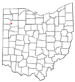
 Location of Cloverdale, Ohio |
|
 Location of Cloverdale in Putnam County |
|
| Coordinates: 41°1′11″N 84°18′18″W / 41.01972°N 84.30500°WCoordinates: 41°1′11″N 84°18′18″W / 41.01972°N 84.30500°W | |
| Country | United States |
| State | Ohio |
| County | Putnam |
| Area | |
| • Total | 0.57 sq mi (1.48 km2) |
| • Land | 0.56 sq mi (1.45 km2) |
| • Water | 0.01 sq mi (0.03 km2) |
| Elevation | 719 ft (219 m) |
| Population (2010) | |
| • Total | 168 |
| • Estimate (2012) | 166 |
| • Density | 300.0/sq mi (115.8/km2) |
| Time zone | Eastern (EST) (UTC-5) |
| • Summer (DST) | EDT (UTC-4) |
| ZIP code | 45827 |
| Area code(s) | 419 |
| FIPS code | 39-16266 |
| GNIS feature ID | 1079575 |
Cloverdale is a village in Putnam County, Ohio, United States. The population was 168 at the 2010 census.
Cloverdale was originally called Evansville, and under the latter name was platted in 1877 when the railroad was extended to that point. The present name most likely is derived from the Clover Leaf Railroad, which passed through a nearby junction. The village was incorporated as Cloverdale in 1902.
Cloverdale is located at 41°1′11″N 84°18′18″W / 41.01972°N 84.30500°W (41.019658, -84.304955).
According to the United States Census Bureau, the village has a total area of 0.57 square miles (1.48 km2), of which 0.56 square miles (1.45 km2) is land and 0.01 square miles (0.03 km2) is water.
As of the census of 2010, there were 168 people, 69 households, and 43 families residing in the village. The population density was 300.0 inhabitants per square mile (115.8/km2). There were 77 housing units at an average density of 137.5 per square mile (53.1/km2). The racial makeup of the village was 95.8% White, 0.6% African American, 0.6% from other races, and 3.0% from two or more races. Hispanic or Latino of any race were 3.0% of the population.
...
Wikipedia
