Clintonville, Connecticut
| North Haven, Connecticut | ||
|---|---|---|
| Town | ||
|
||
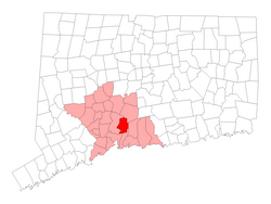
 Location in New Haven County, Connecticut |
||
| Coordinates: 41°22′54″N 72°51′30″W / 41.38167°N 72.85833°WCoordinates: 41°22′54″N 72°51′30″W / 41.38167°N 72.85833°W | ||
| Country | United States | |
| State | Connecticut | |
| NECTA | New Haven | |
| Region | South Central Region | |
| Incorporated | 1786 | |
| Government | ||
| • Type | Selectman-town meeting | |
| • First Selectman | Michael Freda (R) | |
| • Selectman | Timothy M. Doheny (R) | |
| • Selectman | Sally J. Buemi (D) | |
| Area | ||
| • Total | 21.1 sq mi (54.6 km2) | |
| • Land | 20.8 sq mi (53.8 km2) | |
| • Water | 0.3 sq mi (0.8 km2) | |
| Elevation | 66 ft (20 m) | |
| Population (2010) | ||
| • Total | 24,093 | |
| • Density | 1,100/sq mi (440/km2) | |
| Time zone | Eastern (UTC-5) | |
| • Summer (DST) | Eastern (UTC-4) | |
| ZIP code | 06473 | |
| Area code(s) | 203 | |
| FIPS code | 09-54870 | |
| GNIS feature ID | 0213479 | |
| Website | www |
|
North Haven is a town in New Haven County, Connecticut on the outskirts of New Haven, Connecticut. As of the 2010 census, it had a population of 24,093.
North Haven is less than 10 miles (16 km) from downtown New Haven and Yale University. It is near Sleeping Giant State Park and is home of the Quinnipiac University School of Health Sciences, the School of Nursing, School of Law, School of Education, and School of Medicine on Bassett Road North Haven has easy access to Interstate 91 and the Wilbur Cross Parkway (Route 15).
In July 2007, Money magazine ranked North Haven as the eighty-sixth "best place to live" in the United States.
According to the United States Census Bureau, the town has a total area of 21.1 square miles (54.6 km²), of which 20.8 square miles (53.8 km²) is land and 0.3 square miles (0.8 km²), or 1.52%, is water. North Haven is located less than 10 miles (16 km) from Long Island Sound.
North Haven is 27 miles (43 km) south of Hartford, 76 miles (122 km) northeast of New York City, 80 miles (130 km) west of Providence and 115 miles (185 km) southwest of Boston. The center of town is an area stretching along U.S. Route 5, from approximately its interchange with I-91 in the north to Bailey Road in the south.
...
Wikipedia

