Clinchco, Virginia
| Clinchco, Virginia | |
|---|---|
| Town | |
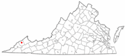
 Location of Clinchco, Virginia |
|
| Coordinates: 37°9′45″N 82°21′36″W / 37.16250°N 82.36000°WCoordinates: 37°9′45″N 82°21′36″W / 37.16250°N 82.36000°W | |
| Country | United States |
| State | Virginia |
| County | Dickenson |
| Area | |
| • Total | 2.84 sq mi (7.35 km2) |
| • Land | 2.80 sq mi (7.26 km2) |
| • Water | 0.03 sq mi (0.08 km2) |
| Elevation | 1,398 ft (426 m) |
| Population (2010) | |
| • Total | 337 |
| • Density | 120/sq mi (46.4/km2) |
| Time zone | Eastern (EST) (UTC-5) |
| • Summer (DST) | EDT (UTC-4) |
| ZIP code | 24226 |
| Area code(s) | 276 |
| FIPS code | 51-17504 |
| GNIS feature ID | 1502782 |
Clinchco is a town in Dickenson County, Virginia, United States. The town, formerly known as Moss, was named for the Clinchfield Railroad, although according to another source the town's name is a contraction of the Clinchfield Coal Co. The population was 337 at the 2010 census, down from 424 at the 2000 census. The Clinchco post office was established in 1917.
Clinchco is located in north-central Dickenson County at 37°9′45″N 82°21′36″W / 37.16250°N 82.36000°W (37.162466, -82.359951), in the valley of the McClure River, a northeast-flowing tributary of the Russell Fork, part of the Levisa Fork/Big Sandy River system leading north to the Ohio River. Virginia State Routes 63 and 83 run through the center of town. VA 83 leads northeast (downriver) 7 miles (11 km) to Haysi, while VA 63 follows a ridge route that takes 10 miles (16 km) to reach Haysi. The two highways run south (upriver) together 5 miles (8 km) to Fremont. St. Paul is 29 miles (47 km) south of Clinchco via VA 63, and Pound is 20 miles (32 km) west via VA 83.
...
Wikipedia
