Clifton Forge, VA
| Clifton Forge, Virginia | ||
|---|---|---|
| Town | ||

Downtown Clifton Forge
|
||
|
||
| Coordinates: 37°49′11″N 79°49′25″W / 37.81972°N 79.82361°W | ||
| Country | United States | |
| State | Virginia | |
| County | Alleghany | |
| Area | ||
| • Total | 3.1 sq mi (8.0 km2) | |
| • Land | 3.1 sq mi (8.0 km2) | |
| • Water | 0.0 sq mi (0.0 km2) | |
| Elevation | 1,083 ft (330 m) | |
| Population (2010) | ||
| • Total | 3,884 | |
| • Density | 1,252.9/sq mi (485.5/km2) | |
| ZIP code | 24422 | |
| Area code(s) | 540 | |
| FIPS code | 51-17440 | |
| GNIS feature ID | 1492780 | |
| Website | Official website | |
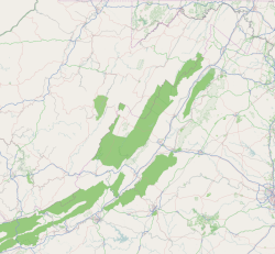
Clifton Forge is a town in Alleghany County, Virginia, United States which is part of the Roanoke Region. The population was 3,884 at the 2010 census. The Jackson River flows through the town, which as a result was once known as Jackson's River Station.
Clifton Forge was an independent city during the 2000 census. However, in 2001, Clifton Forge gave up its city status and reverted to a town. In previous decades, the railroad was a major employer. Clifton Forge is known for its mountain views and clear streams.
Clifton Forge Commercial Historic District, Clifton Forge Residential Historic District, Clifton Furnace, Jefferson School, and Longdale Furnace Historic District are listed on the National Register of Historic Places.
Amtrak, the national passenger rail service, provides service to the Clifton Forge station with the Cardinal route. Also Clifton Forge serves a major locomotive fuel facility for CSX Transportation and is home to the Chesapeake & Ohio Historical Society and C&O Railway Heritage Center.
Clifton Forge is serviced by three major highways, Interstate 64, US 60, and US 220.
...
Wikipedia


