Cleveland, Alabama
| Cleveland, Alabama | |
|---|---|
| Town | |
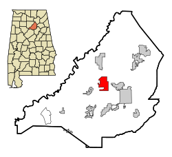
 Location in Blount County and the state of Alabama |
|
| Coordinates: 33°59′31″N 86°34′33″W / 33.99194°N 86.57583°W | |
| Country | United States |
| State | Alabama |
| County | Blount |
| Government | |
| • Type | Town Hall |
| • Mayor | Sir Jeremy Wilson |
| Area | |
| • Total | 7.89 sq mi (20.44 km2) |
| • Land | 7.84 sq mi (20.31 km2) |
| • Water | 0.05 sq mi (0.13 km2) |
| Elevation | 525 ft (160 m) |
| Population (2010) | |
| • Total | 1,303 |
| • Estimate (2016) | 1,313 |
| • Density | 166.37/sq mi (64.24/km2) |
| Time zone | Central (CST) (UTC-6) |
| • Summer (DST) | CDT (UTC-5) |
| ZIP code | 35049 |
| Area code(s) | 205 |
| FIPS code | 01-15472 |
| GNIS feature ID | 0157920 |
Cleveland is a town in Blount County, Alabama, United States. At the 2010 census the population was 1,303.
Cleveland is located in central Blount County at 33°59'31.326" North, 86°34'33.823" West (33.992035, -86.576062). The Locust Fork of the Black Warrior River flows past the northwest side of the town. U.S. Route 231 intersects Alabama State Route 79 north of the center of town. Route 231 leads southeast 7 miles (11 km) to Oneonta, the county seat, and north 56 miles (90 km) to Huntsville. Route 79 leads northeast 31 miles (50 km) to Guntersville and southwest 37 miles (60 km) to Birmingham.
According to the U.S. Census Bureau, the town has a total area of 7.9 square miles (20.4 km2), of which 7.8 square miles (20.3 km2) is land and 0.039 square miles (0.1 km2), or 0.64%, is water.
As of the census of 2010, there were 1,303 people, 464 households, and 358 families residing in the town. The population density was 166 people per square mile (64.2/km2). There were 504 housing units at an average density of 63.8 per square mile (24.7/km2). The racial makeup of the town was 89.2% White, 0.3% Black or African American, 0.2% Native American, 8.6% from other races, and 1.4% from two or more races. 18.4% of the population were Hispanic or Latino of any race.
...
Wikipedia
