Clayton County, Iowa
| Clayton County, Iowa | |
|---|---|

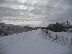
Winter scene near Elkader
|
|
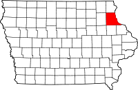
 Location in the U.S. state of Iowa |
|
 Iowa's location in the U.S. |
|
| Founded | 1837 |
| Named for | John M. Clayton |
| Seat | Elkader |
| Largest city | Guttenberg |
| Area | |
| • Total | 793 sq mi (2,054 km2) |
| • Land | 779 sq mi (2,018 km2) |
| • Water | 14 sq mi (36 km2), 1.8% |
| Population | |
| • (2010) | 18,129 |
| • Density | 23/sq mi (9/km²) |
| Congressional district | 1st |
| Time zone | Central: UTC-6/-5 |
| Website | www |
Clayton County is a county located in the U.S. state of Iowa. As of the 2010 census, the population was 18,129. Its county seat is Elkader. The county was established in 1837 and was named in honor of John M. Clayton,United States Senator from Delaware and later Secretary of State under President Zachary Taylor.
According to the U.S. Census Bureau, the county has a total area of 793 square miles (2,050 km2), of which 779 square miles (2,020 km2) is land and 14 square miles (36 km2) (1.8%) is water. It is the fifth-largest county in Iowa by area.
Clayton County is part of the Driftless Area, a region that completely missed being ice-covered during the last ice age. Streams have deeply carved valleys, while the Mississippi River has spectacular bluffs.
The 2010 census recorded a population of 18,129 in the county, with a population density of 23.272/sq mi (8.985/km2). There were 8,999 housing units, of which 7,599 were occupied.
As of the census of 2000, there were 18,678 people, 7,375 households, and 5,132 families residing in the county. The population density was 24 people per square mile (9/km²). There were 8,619 housing units at an average density of 11 per square mile (4/km²). The racial makeup of the county was 98.93% White, 0.14% Black or African American, 0.22% Native American, 0.11% Asian, 0.01% Pacific Islander, 0.19% from other races, and 0.41% from two or more races. 0.76% of the population were Hispanic or Latino of any race.
...
Wikipedia
