Clarksville, Texas
| Clarksville, Texas | |
|---|---|
| City | |
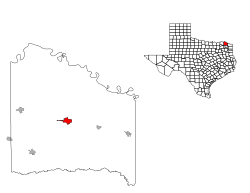
 Location of Clarksville, Texas |
|
 |
|
| Coordinates: 33°36′40″N 95°3′9″W / 33.61111°N 95.05250°WCoordinates: 33°36′40″N 95°3′9″W / 33.61111°N 95.05250°W | |
| Country | United States |
| State | Texas |
| County | Red River |
| Area | |
| • Total | 3.0 sq mi (7.7 km2) |
| • Land | 3.0 sq mi (7.7 km2) |
| • Water | 0.0 sq mi (0.0 km2) |
| Elevation | 410 ft (125 m) |
| Population (2010) | |
| • Total | 3,285 |
| • Density | 1,100/sq mi (430/km2) |
| Time zone | Central (CST) (UTC-6) |
| • Summer (DST) | CDT (UTC-5) |
| ZIP code | 75426 |
| Area code(s) | 903 |
| FIPS code | 48-15160 |
| GNIS feature ID | 1354578 |
Clarksville is a city in Red River County, Texas, in the United States in the northernmost part of the Piney Woods region of East Texas. As of the 2010 census, the city population was 3,285. It is the county seat of Red River County.
Clarksville is located at 33°36′40″N 95°3′9″W / 33.61111°N 95.05250°W (33.611086, -95.052448).
According to the United States Census Bureau, the city has a total area of 3.0 square miles (7.8 km2), all land.
Clarksville was established by James Clark, who moved to the area in 1833 and laid out a town site. The town was incorporated by an act of the Texas Congress in 1837, and within a few years it became an educational and agricultural center.
As of the census of 2000, there were 3,883 people, 1,530 households, and 1,006 families residing in the city. The population density was 1,299.2 people per square mile (501.4/km²). There were 1,787 housing units at an average density of 597.9 per square mile (230.8/km²). The racial makeup of the city was 53.39% White, 42.18% African American, 0.21% Native American, 0.26% Asian, 3.01% from other races, and 0.95% from two or more races. Hispanic or Latino of any race were 7.29% of the population.
...
Wikipedia
