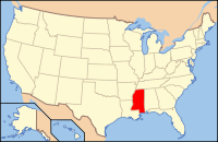
Claiborne County, MS
| Claiborne County, Mississippi | |
|---|---|

Claiborne County courthouse and Confederate Monument in Port Gibson
|
|
 Location in the U.S. state of Mississippi |
|
 Mississippi's location in the U.S. |
|
| Founded | 1802 |
| Named for | William C. C. Claiborne |
| Seat | Port Gibson |
| Largest city | Port Gibson |
| Area | |
| • Total | 501 sq mi (1,298 km2) |
| • Land | 487 sq mi (1,261 km2) |
| • Water | 14 sq mi (36 km2), 2.8% |
| Population (est.) | |
| • (2015) | 9,150 |
| • Density | 20/sq mi (8/km²) |
| Congressional district | 2nd |
| Time zone | Central: UTC-6/-5 |
Claiborne County is a county located in the U.S. state of Mississippi. As of the 2010 census, the population was 9,604. Its county seat is Port Gibson. The county is named after William Claiborne, the second governor of the Mississippi Territory.
Claiborne County is included in the Vicksburg, MS Micropolitan Statistical Area as well as the Jackson-Vicksburg-Brookhaven, MS Combined Statistical Area. It is bordered by the Mississippi River on the west and the Big Black River on the north.
According to the United States Census Bureau, this small county has the third-highest percentage of African-American residents of any U.S. county, an 84% majority of the population. Located south of the area known as the Mississippi Delta, this area was long a center of cotton plantations and related agriculture. Many African Americans have stayed here because of family ties and making the land their own. Claiborne County was the center of a little-known but profound demonstration and struggle during the civil rights movement.
The county had been settled by French, Spanish, and English colonists, and American pioneers as part of the Natchez District; organized in 1802, it was the fourth county in the Mississippi Territory. European-American settlers did not develop the area for cotton plantations until after Indian Removal in the 1830s, at which time they brought in numerous slaves through the domestic slave trade, which transported a million slaves from the Upper South to the Deep South. Using enslaved African Americans as laborers, planters created long, narrow plantations that fronted on the Mississippi to the west and the Big Black River to the north, the transportation byways. As in other parts of the Delta, the bottomlands areas further from the river were frontier and undeveloped until after the American Civil War. Well before the Civil War, the county had a majority-black population.
...
Wikipedia
