City of Dubbo
|
City of Dubbo New South Wales |
|||||||||||||
|---|---|---|---|---|---|---|---|---|---|---|---|---|---|

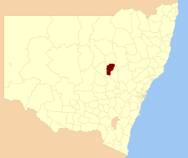
Location in New South Wales
|
|||||||||||||
| Coordinates | 32°15′S 148°36′E / 32.250°S 148.600°ECoordinates: 32°15′S 148°36′E / 32.250°S 148.600°E | ||||||||||||
| Population | 41,211 (2011 census) | ||||||||||||
| • Density | 12.0324/km2 (31.164/sq mi) | ||||||||||||
| Established | 1872 | ||||||||||||
| Abolished | 12 May 2016 | ||||||||||||
| Area | 3,425 km2 (1,322.4 sq mi) | ||||||||||||
| Council seat | Dubbo | ||||||||||||
| Region | Orana | ||||||||||||
| State electorate(s) | Dubbo | ||||||||||||
| Federal Division(s) | Parkes | ||||||||||||
| Website | City of Dubbo | ||||||||||||
|
|||||||||||||
The City of Dubbo was a local government area in the Orana region of New South Wales, Australia. The former area is located adjacent to the Mitchell, Newell, and the Golden highways, the Main Western railway line, and the Macquarie River.
A 2015 review of local government boundaries recommended that the City of Dubbo merge with the Wellington Council to form a new council with an area of 7,536 square kilometres (2,910 sq mi) and support a population of approximately 51,000. Following an independent review, on 12 May 2016 the Minister for Local Government announced the dissolution of the Dubbo City Council and the Welington Shire Council, together with the establishment of the Western Plains Regional Council with immediate effect.
The last mayor of the City of Dubbo was Clr. Mathew Dickerson, an independent politician.
The last deputy mayor of the City of Dubbo was Clr. Ben Shields, an unaligned politician. Clr. Ben Shields was elected in 1st position at the 2012 and 2008 Dubbo City Council elections.
The largest population centre in the former area is the regional city of Dubbo. The local government area also included the villages of Eumungerie, Mogriguy, Brocklehurst, Wongarbon, Toongi, and Rawsonville.
...
Wikipedia
