Citarum
| Citarum River | |
|---|---|

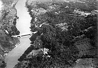
Bridge over the Citarum River
|
|
| Native name | ᮝᮜᮥᮍᮔ᮪ ᮎᮤᮒᮛᮥᮙ᮪ |
| Country | Indonesia |
| Physical characteristics | |
| Main source | Mount Wayang, Bandung Regency, West Java |
| River mouth | Java Sea, Ujung Karawang, Karawang Regency, West Java, |
| Length | 300 km (190 mi) |
Citarum (Sundanese: Walungan Citarum) is the longest and largest river in West Java, Indonesia It is also the third longest river in Java after Bengawan Solo and Brantas. It has an important role in the life of the people of West Java, as it supports agriculture, water supply, fishery, industry, sewerage, electricity, etc. It is currently listed as one of the most polluted rivers in the world.
In Indonesian history the Citarum is linked with the 4th century Tarumanagara kingdom, as the kingdom and the river shared the same etymology, derived from the word "Tarum" (Sundanese for indigo plant). The earlier 4th century BCE prehistoric Buni clay pottery-making culture flourished near the river's mouth. Stone inscriptions, Chinese sources, and archaeological sites such as Batujaya and Cibuaya, suggest that the human habitation and civilization has flourished in and around the river estuaries and river valley as early as 4th century and even earlier.
The river flows in the northwest area of Java with predominantly tropical monsoon climate. The annual average temperature in the area is 24°C. The warmest month is May, when the average temperature is around 26°C, and the coldest is January, at 22°C. The average annual rainfall is 2646 mm. The wettest month is January, with an average of 668 mm rainfall, and the driest is September, with 14 mm rainfall.
There are three hydroelectric powerplant dams installed along the Citarum: Saguling, Cirata, and Ir. H. Djuanda (Jatiluhur), all supplying the electricity for the Bandung and Greater Jakarta areas. The waters from these dams are also used to irrigate vast rice paddies in Karawang and Bekasi area, making northern West Java lowlands as one of the most productive rice farming areas.
...
Wikipedia
