Circleville, Kansas
| Circleville, Kansas | |
|---|---|
| City | |
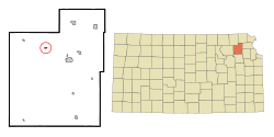
 Location within Jackson County and Kansas |
|
 KDOT map of Jackson County (legend) |
|
| Coordinates: 39°30′32″N 95°51′29″W / 39.50889°N 95.85806°WCoordinates: 39°30′32″N 95°51′29″W / 39.50889°N 95.85806°W | |
| Country | United States |
| State | Kansas |
| County | Jackson |
| Area | |
| • Total | 0.26 sq mi (0.67 km2) |
| • Land | 0.26 sq mi (0.67 km2) |
| • Water | 0 sq mi (0 km2) |
| Elevation | 1,135 ft (346 m) |
| Population (2010) | |
| • Total | 170 |
| • Estimate (2012) | 170 |
| • Density | 650/sq mi (250/km2) |
| Time zone | Central (CST) (UTC-6) |
| • Summer (DST) | CDT (UTC-5) |
| ZIP code | 66416 |
| Area code | 785 |
| FIPS code | 20-13375 |
| GNIS feature ID | 0473452 |
Circleville is a city in Jackson County, Kansas, United States. As of the 2010 census, the city population was 170.
Circleville was founded in 1863. It may have been named after Circleville, Ohio, or because the town "circled" around the prairie.
Circleville is located at 39°30′32″N 95°51′29″W / 39.50889°N 95.85806°W (39.508927, -95.858045). According to the United States Census Bureau, the city has a total area of 0.26 square miles (0.67 km2), all of it land.
This climatic region is typified by large seasonal temperature differences, with warm to hot (and often humid) summers and cold (sometimes severely cold) winters. According to the Köppen Climate Classification system, Circleville has a humid subtropical climate, abbreviated "Cfa" on climate maps.
Circleville is part of the Topeka, Kansas Metropolitan Statistical Area.
As of the census of 2010, there were 170 people, 69 households, and 47 families residing in the city. The population density was 653.8 inhabitants per square mile (252.4/km2). There were 77 housing units at an average density of 296.2 per square mile (114.4/km2). The racial makeup of the city was 95.3% White, 0.6% African American, and 4.1% Native American. Hispanic or Latino of any race were 1.2% of the population.
...
Wikipedia
