Cincar
| Cincar | |
|---|---|

A view of the Cincar peak
|
|
| Highest point | |
| Elevation | 2,006 m (6,581 ft) |
| Prominence | 790 metres (2,590 ft) |
| Isolation | 43 kilometres (27 mi) |
| Coordinates | 43°54′08″N 17°03′46″E / 43.90222°N 17.06278°ECoordinates: 43°54′08″N 17°03′46″E / 43.90222°N 17.06278°E |
| Geography | |
| Location |
|
| Parent range | Dinaric Alps |
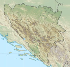
Cincar is a mountain in the Dinaric Alps of western Bosnia and Herzegovina, located at 43°54′08″N 17°03′46″E / 43.90222°N 17.06278°E between Livno, Kupres and Glamoč. The highest peak is the eponymous Cincar peak at 2,006 m (6,581 ft).
...
Wikipedia

