Cimarron, KS
| Cimarron, Kansas | |
|---|---|
| City | |

Historic 1886 Cimarron Hotel
|
|
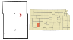
 Location within Gray County and Kansas |
|
 KDOT map of Gray County (legend) |
|
| Coordinates: 37°48′30″N 100°20′51″W / 37.80833°N 100.34750°WCoordinates: 37°48′30″N 100°20′51″W / 37.80833°N 100.34750°W | |
| Country | United States |
| State | Kansas |
| County | Gray |
| Settled | 1878 |
| Area | |
| • Total | 1.14 sq mi (2.95 km2) |
| • Land | 1.14 sq mi (2.95 km2) |
| • Water | 0 sq mi (0 km2) |
| Elevation | 2,635 ft (803 m) |
| Population (2010) | |
| • Total | 2,184 |
| • Estimate (2016) | 2,222 |
| • Density | 1,900/sq mi (740/km2) |
| Time zone | Central (CST) (UTC-6) |
| • Summer (DST) | CDT (UTC-5) |
| ZIP code | 67835 |
| Area code(s) | 620 |
| FIPS code | 20-13275 |
| GNIS feature ID | 0471654 |
| Website | CimarronKS.org |
Cimarron is a city in and the county seat of Gray County, Kansas, United States. As of the 2010 census, the city population was 2,184.
Cimarron was first settled in 1878. It took its name from a fork in the Chisholm Trail which led travelers to the Cimarron River.
Between 1887 and 1893, a county seat war took place in Gray County that involved several notable Old West figures, such as Bat Masterson, Bill Tilghman, and Ben Daniels. As a result of the dispute, Cimarron became the permanent county seat of Gray County.
In the wee hours of June 10, 1893, Bill Doolin and four members of his gang robbed a train one-half mile east of Cimarron.
Cimarron is located at 37°48′30″N 100°20′51″W / 37.80833°N 100.34750°W (37.808332, −100.347413). According to the United States Census Bureau, the city has a total area of 1.14 square miles (2.95 km2), all of it land.
According to the Köppen Climate Classification system, Cimarron has a semi-arid climate, abbreviated "BSk" on climate maps.
As of the census of 2010, there were 2,184 people, 789 households, and 569 families residing in the city. The population density was 1,915.8 inhabitants per square mile (739.7/km2). There were 842 housing units at an average density of 738.6 per square mile (285.2/km2). The racial makeup of the city was 92.2% White, 0.1% African American, 0.5% Native American, 0.4% Asian, 5.4% from other races, and 1.3% from two or more races. Hispanic or Latino of any race were 19.1% of the population.
...
Wikipedia
