Chumphon
|
Chumphon ชุมพร |
|
|---|---|
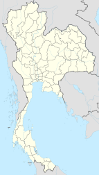
| Location in Thailand | |
| Coordinates: 10°29′38″N 99°10′48″E / 10.49389°N 99.18000°E | |
| Country |
|
| Province | Chumphon Province |
| District | Amphoe Mueang Chumphon |
| Elevation | 39 ft (12 m) |
| Population (2005) | |
| • Total | 33,522 |
| Time zone | ICT (UTC+7) |
Chumphon (Thai: ชุมพร, pronounced [t͡ɕʰūm.pʰɔ̄ːn]) is a town (thesaban mueang) in southern Thailand, capital of the Chumphon Province and the Mueang Chumphon District. The city is about 463 kilometers (288 miles) from Bangkok. As of 2005 it had a population of 33,522. The town covers the commune (tambon) Tha Taphao completely and parts of tambons Bang Mak, Wang Phai, Na Thung, Tak Daet, and Khun Krathing. The main economic sector of Chumphon is agriculture.
Chumphon volunteers fought invading Japanese during World War II. Chumphon became a rail hub for Imperial Japan. It was a station on the Southern Line and connected to the short-live Kra Isthmus Railway.
Chumphon lies just inland from the west coast of the Gulf of Thailand. To the west are the northern hills of the Phuket Range, a subrange of the Tenasserim Hills. These hills reach 400 metres (1,300 ft) in the area near Chumphon. There are also many smaller peaks in the area in the range of 100 metres (330 ft) to 200 metres (660 ft) high.
Chumphon has a tropical monsoon climate (Köppen climate classification Am) just falling short of a tropical rainforest climate (Köppen Af). Temperatures are hot throughout the year. The period from December to April has relatively less rainfall than from May to November, when rainfall can be very heavy, particularly in October and November.
...
Wikipedia

