Cho Oyu
| Cho Oyu | |
|---|---|

The south side of Cho Oyu from Gokyo.
|
|
| Highest point | |
| Elevation | 8,188 m (26,864 ft) Ranked 6th |
| Prominence | 2,340 m (7,680 ft) |
| Isolation | 29 kilometres (18 mi) |
| Listing |
Eight-thousander Ultra |
| Coordinates | 28°05′39″N 86°39′39″E / 28.09417°N 86.66083°ECoordinates: 28°05′39″N 86°39′39″E / 28.09417°N 86.66083°E |
| Naming | |
| Translation | Turquoise Goddess (Tibetan) |
| Geography | |
| Location | Nepal–China (Tibet) |
| Parent range | Mahalangur Himal, Himalayas |
| Climbing | |
| First ascent | October 19, 1954 by Herbert Tichy, Joseph Jöchler, Pasang Dawa Lama (First winter ascent 12 February 1985 Maciej Berbeka and Maciej Pawlikowski) |
| Easiest route | snow/ice/glacier climb |
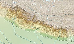
Cho Oyu (Nepali: चोयु; Tibetan: ཇོ་བོ་དབུ་ཡ) is the sixth highest mountain in the world at 8,188 metres (26,864 ft) above sea level. Cho Oyu means "Turquoise Goddess" in Tibetan. The mountain is the westernmost major peak of the Khumbu sub-section of the Mahalangur Himalaya 20 km west of Mount Everest. The mountain stands on the China-Nepal border.
Just a few kilometres west of Cho Oyu is Nangpa La (5,716m/18,753 ft), a glaciated pass that serves as the main trading route between the Tibetans and the Khumbu's Sherpas. This pass separates the Khumbu and Rolwaling Himalayas. Due to its proximity to this pass and the generally moderate slopes of the standard northwest ridge route, Cho Oyu is considered the easiest 8,000 metre peak to climb. It is a popular objective for professionally guided parties.
Cho Oyu's height was originally measured at 26,750 feet (8,150 m) and at the time of the first ascent it was considered the 7th highest mountain on earth, after Dhaulagiri at 8,167 metres (26,795 ft) (Manaslu, now 8,156 metres (26,759 ft), was also estimated lower at 26,658 feet (8,125 m)). A 1984 estimate of 8,201 metres (26,906 ft) made it move up to 6th place. New measurements made in 1996 by the Government of Nepal Survey Department and the Finnish Meteorological Institute in preparation for the Nepal Topographic Maps put the height at 8,188 m, one remarkably similar to the 26,867 feet (8,189 m) used by Edmund Hillary in his 1955 book High Adventure.
...
Wikipedia


