Chitina, Alaska
|
Chitina Tsedi Na’ |
|
|---|---|
| CDP | |

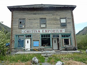
Chitina Emporium in 2011
|
|
 Location of Chitina, Alaska |
|
| Coordinates: 61°30′57″N 144°26′12″W / 61.51583°N 144.43667°WCoordinates: 61°30′57″N 144°26′12″W / 61.51583°N 144.43667°W | |
| Country | United States |
| State | Alaska |
| Census Area | Valdez-Cordova |
| Government | |
| • State senator | Click Bishop (R) |
| • State rep. | Dave Talerico (R) |
| Area | |
| • Total | 95.8 sq mi (248 km2) |
| • Land | 84.6 sq mi (219.2 km2) |
| • Water | 11.1 sq mi (28.8 km2) |
| Population (2010) | |
| • Total | 126 |
| Time zone | Alaska (AKST) (UTC-9) |
| • Summer (DST) | AKDT (UTC-8) |
| ZIP code | 99566 |
| Area code(s) | 907 |
| FIPS code | 02-14110 |
Chitina (/tʃɪtˈ.nʌ/ or /tʃɪ.tiːˈ.nʌ/;Ahtna Athabascan Tsedi Na’ [tʃɛ.diː.näʔ] < tsedi "copper" + na’ "river") is a census-designated place (CDP) in Valdez-Cordova Census Area, Alaska, United States. At the 2010 census the population was 126.
Chitina is located on the west bank of the Copper River at its confluence with the Chitina River on the Edgerton Highway, and junction with the McCarthy Road. It is 85 km (53 mi) southeast of Copper Center and 106 km (66 mi) southeast of Glennallen. It is outside the western boundary of the Wrangell - St Elias National Park and Preserve.
...
Wikipedia
