Chhatarpur
|
Chhatarpur छतरपुर |
|
|---|---|
| city | |
| Coordinates: 24°38′N 79°30′E / 24.63°N 79.5°ECoordinates: 24°38′N 79°30′E / 24.63°N 79.5°E | |
| Country | India |
| State | Madhya Pradesh |
| District | Chhatarpur |
| Named for | Chhatrasal |
| Area | |
| • Total | 50 km2 (20 sq mi) |
| Elevation | 305 m (1,001 ft) |
| Population (2011) | |
| • Total | 147 669 |
| • Density | 2,554/km2 (6,610/sq mi) |
| Languages | |
| • Official | Hindi[Bundeli] |
| Time zone | IST (UTC+5:30) |
| PIN | 471001 |
| Telephone code | 07682 |
| Vehicle registration | MP-16 |
| Sex ratio | 920 ♂/♀ |
| Website | chhatarpur |
Chhatarpur is a city and a municipality in Chhatarpur district in the state of Madhya Pradesh, India. It is the administrative headquarters of Chhatarpur District.
Chhatarpur was founded in 1785 and is named after the Bundela Rajput leader Chhatrasal, the founder of Bundelkhand independence, and contains his cenotaph. The state was ruled by his descendants until 1785. At that time the Ponwar clan of the Rajputs took control of Chhatarpur. The state was guaranteed to Kunwar Sone Singh Ponwar in 1806 by the British Raj. In 1854 Chhatarpur would have lapsed to the British government for want of direct heirs under the doctrine of lapse, but was conferred on Jagat Raj as a special act of grace. The Ponwar Rajas ruled a princely state with an area of 1,118 square miles (2,900 km2), and population of 156,139 in 1901, which was part of the Bundelkhand agency of Central India.
In 1901 the town of Chhatarpur had a population of 10,029, a high school and manufactured paper and coarse cutlery. The state also contained the British cantonment of Nowgong.
After the independence of India in 1947, the Rajas of Chhatarpur acceded to India, and Chhatarpur, together with the rest of Bundelkhand, became part of the Indian state of Vindhya Pradesh. Vindhya Pradesh was later merged into the state of Madhya Pradesh in 1956.
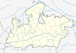
Chhatarpur is located at 24°54′N 79°36′E / 24.9°N 79.6°E. It has an average elevation of 305 metres (1000 feet). It is located on the far north-east border of Madhya Pradesh, sharing its borders with the Banda district of Uttar Pradesh. It is 133 km from Jhansi in Uttar Pradesh and 233 km from Gwalior in Madhya Pradesh.
...
Wikipedia


