Chesterfield County, South Carolina
| Chesterfield County, South Carolina | |||
|---|---|---|---|
|
|||
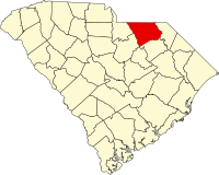
 Location in the U.S. state of South Carolina |
|||
 South Carolina's location in the U.S. |
|||
| Founded | 1785 | ||
| Seat | Chesterfield | ||
| Largest town | Cheraw | ||
| Area | |||
| • Total | 806 sq mi (2,088 km2) | ||
| • Land | 799 sq mi (2,069 km2) | ||
| • Water | 6.7 sq mi (17 km2), 0.8% | ||
| Population (est.) | |||
| • (2015) | 46,017 | ||
| • Density | 58/sq mi (22/km²) | ||
| Congressional district | 7th | ||
| Time zone | Eastern: UTC-5/-4 | ||
| Website | www |
||
Chesterfield County is a county located in the U.S. state of South Carolina. As of the 2010 census, its population was 46,734. Its county seat is Chesterfield. The county was formed in 1785, but was part of the Cheraws District until 1800, at which time Chesterfield became a district. Under the 1867 state constitution passed during the Reconstruction era, South Carolina districts became counties with home rule. It is located north of the Midlands, on its border with North Carolina.
According to the U.S. Census Bureau, the county has a total area of 806 square miles (2,090 km2), of which 799 square miles (2,070 km2) is land and 6.7 square miles (17 km2) (0.8%) is water.
As of the census of 2000, there were 42,768 people, 16,557 households, and 11,705 families residing in the county. The population density was 54 people per square mile (21/km²). There were 18,818 housing units at an average density of 24 per square mile (9/km²). The racial makeup of the county was 64.34% White, 33.22% Black or African American, 0.34% Native American, 0.30% Asian, 0.02% Pacific Islander, 1.04% from other races, and 0.75% from two or more races. 2.27% of the population were Hispanic or Latino of any race.
...
Wikipedia


