Chesterfield, New Jersey
| Chesterfield Township, New Jersey | |
|---|---|
| Township | |
| Township of Chesterfield | |

Recklesstown
|
|
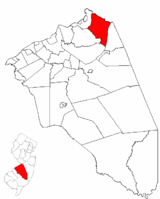
 Chesterfield Township highlighted in Burlington County. Inset map: Burlington County highlighted in the State of New Jersey. |
|
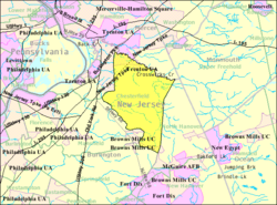
 Census Bureau map of Chesterfield Township, New Jersey |
|
| Coordinates: 40°07′13″N 74°39′13″W / 40.120242°N 74.653491°WCoordinates: 40°07′13″N 74°39′13″W / 40.120242°N 74.653491°W | |
| Country | |
| State |
|
| County | Burlington |
| Formed | November 6, 1688 |
| Royal charter | January 10, 1713 |
| Incorporated | February 21, 1798 |
| Named for | Chesterfield, England |
| Government | |
| • Type | Township |
| • Body | Township Committee |
| • Mayor | Jeremy I. Liedtka (R, term ends December 31, 2016) |
| • Clerk | Caryn Hoyer |
| Area | |
| • Total | 21.520 sq mi (55.735 km2) |
| • Land | 21.334 sq mi (55.254 km2) |
| • Water | 0.186 sq mi (0.481 km2) 0.86% |
| Area rank | 131st of 566 in state 14th of 40 in county |
| Elevation | 92 ft (28 m) |
| Population (2010 Census) | |
| • Total | 7,699 |
| • Estimate (2015) | 7,572 |
| • Rank | 297th of 566 in state 21st of 40 in county |
| • Density | 360.9/sq mi (139.3/km2) |
| • Density rank | 465th of 566 in state 32nd of 40 in county |
| Time zone | Eastern (EST) (UTC-5) |
| • Summer (DST) | Eastern (EDT) (UTC-4) |
| ZIP code | 08515 - Crosswicks |
| Area code(s) | 609 exchanges: 291, 298 |
| FIPS code | 3400512670 |
| GNIS feature ID | 0882109 |
| Website | www |
Chesterfield Township is a township in Burlington County, New Jersey, United States. As of the 2010 United States Census, the township's population was 7,699, reflecting an increase of 1,744 (+29.3%) from the 5,955 counted in the 2000 Census, which had in turn increased by 803 (+15.6%) from the 5,152 counted in the 1990 Census.
Chesterfield has permanently preserved more than 7,000 acres (2,800 ha) of farmland through state and county programs and a township-wide transfer of development credits program that directs future growth to a designated "receiving area" known as Old York Village, which is a neo-traditional, New Urbanism community built on 560 acres (230 ha) incorporating a variety of housing types, neighborhood commercial facilities, a new elementary school, civic uses, and active and passive open space areas with preserved agricultural land surrounding the planned village. Construction began in the early 2000s and a significant percentage of the community is now complete. As of 2016 the construction is still on going and there is soon to be Chesterfield's first retail outlet, along with more condos and homes. Old York Village was the winner of the American Planning Association's National Outstanding Planning Award in 2004.
The land was first settled in 1677, when a group of primarily Quaker immigrants from England established the settlement of Crosswicks, the oldest of the three communities of the township. The village was named after the Crosswicks Creek that separates Burlington and Mercer counties. The other two villages were Recklesstown (now Chesterfield) and Plattsburg (now Sykesville). Recklesstown was named in honor of one of its founders, Joseph Reckless, until the community's name was changed in 1888 at the urging of a Congressman and local resident in the face of public scorn.
Chesterfield Township was originally formed on November 6, 1688. It was named after the 2nd Earl of Chesterfield whose seat of Chesterfield was in Derbyshire, where many of the township's earliest settlers had lived. The township was reformed by Royal charter on January 10, 1713, and was incorporated as one of New Jersey's initial 104 townships by the Township Act of 1798 of the New Jersey Legislature on February 21, 1798. Portions of the township were taken to form New Hanover Township (December 2, 1723) and Bordentown borough (December 9, 1825).
...
Wikipedia
