Chesterfield, Massachusetts
| Chesterfield, Massachusetts | ||
|---|---|---|
| Town | ||

Post Office
|
||
|
||
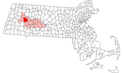
 Location in Hampshire County in Massachusetts |
||
| Coordinates: 42°23′30″N 72°50′25″W / 42.39167°N 72.84028°WCoordinates: 42°23′30″N 72°50′25″W / 42.39167°N 72.84028°W | ||
| Country | United States | |
| State | Massachusetts | |
| County | Hampshire | |
| Settled | 1760 | |
| Incorporated | 1762 | |
| Government | ||
| • Type | Open town meeting | |
| Area | ||
| • Total | 31.3 sq mi (81.0 km2) | |
| • Land | 31.1 sq mi (80.5 km2) | |
| • Water | 0.2 sq mi (0.5 km2) | |
| Elevation | 1,427 ft (435 m) | |
| Population (2010) | ||
| • Total | 1,222 | |
| • Density | 38.6/sq mi (14.9/km2) | |
| Time zone | Eastern (UTC-5) | |
| • Summer (DST) | Eastern (UTC-4) | |
| ZIP code | 01012 | |
| Area code(s) | 413 | |
| FIPS code | 25-13590 | |
| GNIS feature ID | 0618197 | |
| Website | www.townofchesterfieldma.com | |
Chesterfield is a rural hill town in Hampshire County, Massachusetts, United States, 26 miles southeast of Pittsfield and 108 miles west of Boston. The population was 1,222 at the 2010 census. It is part of the Springfield, Massachusetts Metropolitan Statistical Area.
Chesterfield was first settled in 1760 and was officially incorporated in 1762. It was named after the Earl of Chesterfield. The town center, established after the Revolution, has well-preserved Federal Period houses along Main Road. In its early days, the town supported a largely agricultural economy, with wool from Merino sheep as a major product. However, there were sawmills and tanneries in operation as well as cloth dressing mills, and in the early 19th century these superseded farming and brought in a small immigrant population that was mostly Irish. Progress wiped out most of the industry in Chesterfield and by the start of the 20th century a re-emerging agricultural economy developed alongside the growing trade from summer residents.
According to the United States Census Bureau, the town has a total area of 31.3 square miles (81 km2), of which 31.1 square miles (81 km2) is land and 0.2 square miles (0.52 km2) (0.61%) is water. Chesterfield's location is nearly equidistant from the northern, southern and western state lines of Massachusetts.
Chesterfield is located 52 miles (84 km) north of Hartford, Connecticut, 108 miles (174 km) west of Boston, 30 miles (48 km) northwest of Springfield, 64 miles (103 km) southeast of Albany, New York, 26 miles (42 km) east of Pittsfield, and 160 miles (260 km) northeast of New York City.
...
Wikipedia

