Chesapeake Academy
| Arnold, Maryland | |
|---|---|
| Census-designated place | |
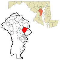
 Location of Arnold, Maryland |
|
| Coordinates: 39°2′50″N 76°29′48″W / 39.04722°N 76.49667°WCoordinates: 39°2′50″N 76°29′48″W / 39.04722°N 76.49667°W | |
| Country | |
| State |
|
| County |
|
| Area | |
| • Total | 13.6 sq mi (35.1 km2) |
| • Land | 10.8 sq mi (28.0 km2) |
| • Water | 2.7 sq mi (7.1 km2) |
| Elevation | 128 ft (39 m) |
| Population (2010) | |
| • Total | 23,106 |
| • Density | 2,136/sq mi (824.7/km2) |
| Time zone | Eastern (EST) (UTC-5) |
| • Summer (DST) | EDT (UTC-4) |
| ZIP code | 21012 |
| Area code(s) | 410 |
| FIPS code | 24-02275 |
| GNIS feature ID | 0582920 |
Arnold is a suburb of Annapolis and a census-designated place (CDP) in Anne Arundel County, Maryland, United States. The population was 23,106 at the 2010 census. Neighborhoods straddle College Parkway and Maryland Route 2 (Ritchie Highway). Arnold is located on the scenic Broadneck peninsula. The ZIP code is 21012.
Native Americans are known to have resided in the region in Pre-Columbian times based on artifacts found in the Ulmstead Point area dating back to the Archaic period (5000–1500 BC). Later tribes to have been in the area include the Algonquin tribes. However, when Captain John Smith arrived in the area in 1608, he reported no Natives.
The early settlement of Arnold, an area between the Magothy and Severn rivers, began with the farm of John Arnold. Arnold, a veteran of the War of 1812, acquired 300 acres (1.2 km2) on the north side of the Severn River.
Arnold is served by the Anne Arundel County Public School System.
Elementary schools:
Middle schools:
High school:
Private schools:
Post-Secondary
Anne Arundel Community College
Arnold is located at 39°2′50″N 76°29′48″W / 39.04722°N 76.49667°W (39.047263, −76.496552). It is 5 miles (8 km) north of Annapolis, the state capital, and 24 miles (39 km) south of downtown Baltimore.
...
Wikipedia
