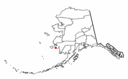
Chefornak, Alaska
|
Chefornak Cevv’arneq |
|
|---|---|
| City | |
 Location of Chefornak, Alaska |
|
| Coordinates: 60°9′33″N 164°16′10″W / 60.15917°N 164.26944°W | |
| Country | United States |
| State | Alaska |
| Census Area | Bethel |
| Incorporated | 1974 |
| Government | |
| • Mayor | Rosalie Matthew |
| • State senator | Lyman Hoffman (D) |
| • State rep. | Zach Fansler (D) |
| Area | |
| • Total | 6.4 sq mi (16.6 km2) |
| • Land | 5.7 sq mi (14.8 km2) |
| • Water | 0.7 sq mi (1.7 km2) |
| Elevation | 0 ft (0 m) |
| Population (2010) | |
| • Total | 418 |
| • Density | 73/sq mi (28.2/km2) |
| Time zone | Alaska (AKST) (UTC-9) |
| • Summer (DST) | AKDT (UTC-8) |
| ZIP code | 99561 |
| Area code | 907 |
| FIPS code | 02-12680 |
Chefornak (Cevv’arneq in Central Yup'ik) is a city in Bethel Census Area, Alaska, United States. At the 2010 census the population was 418.
Chefornak is located at 60°9′33″N 164°16′10″W / 60.15917°N 164.26944°W (60.159070, -164.269437) on the south bank of the Kinia River 16 miles (26 km) upriver from its mouth in Etolin Strait, an arm of the Bering Sea. It is within the Yukon Delta National Wildlife Refuge.
According to the United States Census Bureau, the city has a total area of 6.4 square miles (16.6 km2), of which 5.7 square miles (14.8 km2) is land and 0.66 square miles (1.7 km2), or 10.56%, is water.
Located in a region where the arctic tundra meets and interacts with the Bering Sea, as well as being in a region impacted by past volcanism, Chefornak has many interesting local landmarks.
An extinct volcano, Tern Mountain, is visible in the distance to the south. Large, blocky, igneous rocks are a common sight in the village and the surrounding tundra.
The Kinia River (Urrsukvaaq) and its many tributaries are important to the people of the village, because of water travel to hunting and fishing areas, as well as because of difficulties presented by flooding and erosion.
As of the census of 2000, there were 394 people, 75 households, and 63 families residing in the city. The population density was 68.8 people per square mile (26.5/km²). There were 82 housing units at an average density of 14.3 per square mile (5.5/km²). The racial makeup of the city was 93.40% Alaska Native, 2.03% White, and 4.57% from two or more races.
...
Wikipedia
