Cheatham Annex
| Cheatham Annex | |
| Military base | |
|
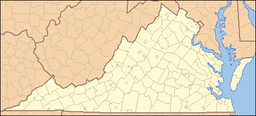
Cheatham is on the York River, in Virginia
|
|
| Eponym: RADM Joseph Johnston Cheatham, 1929 1929 Chief of the Bureau of Supplies and Accounts | |
| Country | United States |
|---|---|
| State | Virginia |
| County | York County |
| Part of | Navy Expeditionary Logistics Support Group |
| Parts | Cheatham Annex |
| Elevation | 28 ft (9 m) |
| Coordinates | 37°17′8″N 76°36′24″W / 37.28556°N 76.60667°WCoordinates: 37°17′8″N 76°36′24″W / 37.28556°N 76.60667°W |
| Area | 3.59 sq mi (9.3 km2) |
| Population | 1,000 |
| Access | Controlled |
| GNIS ID | 1477978 |
Cheatham Annex is a Naval Base, located near Williamsburg, Virginia on the York River approximately 35 miles northwest of Norfolk in the heart of the famous Jamestown–Williamsburg–Yorktown "Historic Triangle." Although Cheatham Annex was not commissioned until June 1943, the land on which the base is located can claim the unique distinction of having been associated with every conflict involving the United States freedom and independence. The mission of Cheatham Annex includes supplying Atlantic Fleet ships and providing recreational opportunities to military and civilian personnel.
Cheatham Annex facility is located outside of Williamsburg in York County, Virginia. The annex is adjacent to the York River, between Queen Creek and King Creek, approximately 15 miles upstream from the Chesapeake Bay. Located in York County, Virginia at latitude 37.284 and longitude -76.591. or Latitude: 37°17’2”N Longitude: 76°35’25”W. The average elevation is 26 feet. 5” The eastern section of Cheatham Annex is a 1,579 acre federal facility bounded by the entrance of Queen Creek into the York River to the north, the York River to the east, ane King Creek to the south, the western boundaries are with Department of Interior (DOI) property. The former Virginia Fuel Farm is across the Colonial Parkway, southwest of this section of the annex. This former part of Cheatham Annex, 262 acres of contamintated soil, is being turned into a golf course.
The western section of Cheatham Annex is bounded to the north by the Colonial Parkway, and half of the eastern boundary is adjacent to the Virginia Fuel Farm. The remaining western, southern, and lower eastern boundary is adjacent to non-federal government land. There are several ponds on, or adjacent to the annex, including Penniman Lake, Youth Pond, Jones Pond, and Cheatham Pond. Overland drainage from the sources at the annex may flow into these ponds or the York River
Positioned in the center of the Jamestown–Williamsburg–Yorktown "Historic Triangle," CAX was once the location of a native Indian village.
Old maps and artifacts indicate an Indian village existed in the area of Penniman Spit, located on base. Historians believe that a Spanish Jesuit Mission occupied the area and was annihilated in an Indian massacre in 1572. Beginning in the 1700s colonial settlers gradually displaced the Indians. The initial settlement of Virginia was the task of the Virginia Company, a private English corporation. From the founding of Jamestown in 1607 to dissolution of the company in 1624, colonization activity was confined to the James River, and practically everyone in the Colony lived on the banks of this one river.
A census taken when the crown assumed administration of the fledgling Colony lists a total of 1,232 individuals alive in Virginia in January 1625. Included among the 1,232 were Ensign John Utie, his wife Anne, their son John, and three servants living on a plantation of 100 acres called Utopia, on the James River below Jamestown. In 1630, the Governor decided to settle the lands along the lower York River, and Captain John Utie was awarded 600 acres on the south side of the river. Captain Utie named his new plantation Ultimaria and lived there until November 1638, by which time he died. His son John Utie acquired Ultimaria and possessed it until it was sold to William Taylor in 1640. Colonel William Taylor's widow, Elizabeth Kingsmill, married Colonel Nathaniel Bacon and they used King's Creek (as it was then called) as their residence, though they owned other property. This Colonel Bacon, who rose to the president of the Council of the State, was first cousin once removed of Nathaniel Bacon, Jr., who led Bacon's Rebellion. Another resident of King's Creek was Colonel Bacon's young niece, Abigail Smith. Sometime before 1675, Abigail Smith married Lewis Burwell I, a prosperous planter.
...
Wikipedia


