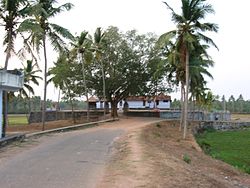
Chathannoor
|
Chathannoor ചാത്തന്നൂര് |
|
|---|---|
| Town | |

Chenamathu Shiva Temple
|
|
| Location in Kerala, India | |
| Coordinates: 8°51′24″N 76°43′5″E / 8.85667°N 76.71806°ECoordinates: 8°51′24″N 76°43′5″E / 8.85667°N 76.71806°E | |
| Country |
|
| State | Kerala |
| District | Kollam |
| Languages | |
| • Official | Malayalam, English |
| Time zone | IST (UTC+5:30) |
| PIN | 691572 |
| Telephone code | 0474-259*** & 0474-2059*** |
| Vehicle registration | KL-02 |
| Nearest city | Kollam City (16 km) |
| Nearest Town | Chathannoor, Paravur (8 km) |
| Literacy | 88% |
Chathannoor is a town in Kerala situated at the Kollam District on the banks of Ithikkara River. It is about 16 KM from Kollam City. Chathannoor is in the extreme east part of Kollam District of Kerala, around 55 km north of the state capital Thiruvananthapuram.Kollam Railway Station is only 16 km from the town and is well connected by buses. Nearest Airport is Thiruvananthapuram International Airport.It is around 50 km north of the state capital Thiruvananthapuram on the National Highway 66 (Formerly NH 47). We can easily access Paravoor, and Varkala towns from here.NH 66 is passing through the center of the Chathannoor town. It is one of the fastest developing towns in Kerala. It is a Special Grade Panchayath in Kollam District.
Chathannoor is located at 8°51′24″N 76°43′5″E / 8.85667°N 76.71806°E.
Chathannoor is well connected to other parts of Kerala by road. National Highway (NH66), which connects Panavel and Kanyakumari, passes through Chathannoor. NH 66 is passing through the centre of the town. Nearest Railway Station is Paravur, about 8 km. Kollam Railway station is 16 km from the town and is well connected by buses. The nearest airport is Thiruvananthapuram International Airport. Buses plying between Kottarakara and Chathannoor are aplenty.
The proximity to Paravur town and railway station is increasing Chathannoor's demand as a major reseidential area in the district.
...
Wikipedia

