Charlestown Township, Chester County, Pennsylvania
| Charlestown Township | |
| Township | |
|
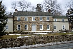
Martin-Little House, built 1735
|
|
| Country | United States |
|---|---|
| State | Pennsylvania |
| County | Chester |
| Elevation | 223 ft (68.0 m) |
| Coordinates | 40°06′01″N 75°33′03″W / 40.10028°N 75.55083°WCoordinates: 40°06′01″N 75°33′03″W / 40.10028°N 75.55083°W |
| Area | 12.6 sq mi (32.6 km2) |
| - land | 12.5 sq mi (32 km2) |
| - water | 0.04 sq mi (0 km2), 0.32% |
| Population | 5,671 (2010) |
| Density | 450.1/sq mi (173.8/km2) |
| Timezone | EST (UTC-5) |
| - summer (DST) | EDT (UTC-4) |
| Area code | 610 |
|
Website: www |
|
|
|
Charlestown Township is a township in Chester County, Pennsylvania, United States. The population was 5,671 at the 2010 census.
Part of the Valley Forge Christian College's campus, formerly the location of the Valley Forge General Hospital, is located in Charlestown Township. The other part is located in Schuylkill Township. The campus straddles the township line.
The Charlestown Village Historic District, Middle Pickering Rural Historic District, Martin-Little House, Oskar G. Stonorov House, John Williams Farm, and Jacob Wisner House are listed on the National Register of Historic Places.
According to the United States Census Bureau, the township has a total area of 12.6 square miles (33 km2), of which, 12.5 square miles (32 km2) of it is land and 0.04 square miles (0.10 km2) of it (0.16%) is water.
Adjacent Townships
No incorporated municipalities are adjacent to Charlestown Township.
At the 2010 census, the township was 84.4% non-Hispanic White, 2.3% Black or African American, 0.2% Native American, 9.0% Asian, and 1.8% were two or more races. 2.6% of the population were of Hispanic or Latino ancestry [1].
As of the census of 2000, there were 4,051 people, 1,340 households, and 1,003 families residing in the township. The population density was 323.3 people per square mile (124.8/km²). There were 1,397 housing units at an average density of 111.5/sq mi (43.0/km²). The racial makeup of the township was 95.36% White, 1.56% African American, 0.17% Native American, 1.70% Asian, 0.02% Pacific Islander, 0.25% from other races, and 0.94% from two or more races. Hispanic or Latino of any race were 1.38% of the population.
...
Wikipedia


