Charleston Township, Pennsylvania
| Charleston Township, Pennsylvania |
|
|---|---|
| Township | |

A picnic area at Hills Creek State Park in Charleston Township
|
|
 Map of Tioga County with Charleston Township highlighted |
|
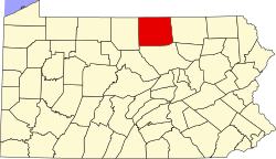
 Map of Pennsylvania highlighting Tioga County |
|
| Country | United States |
| State | Pennsylvania |
| County | Tioga |
| Settled | 1805 |
| Incorporated | 1820 |
| Area | |
| • Total | 52.50 sq mi (135.98 km2) |
| • Land | 52.16 sq mi (135.09 km2) |
| • Water | 0.34 sq mi (0.89 km2) |
| Population (2010) | |
| • Total | 3,360 |
| • Estimate (2016) | 3,450 |
| • Density | 66.15/sq mi (25.54/km2) |
| Time zone | Eastern Time Zone (North America) |
| • Summer (DST) | EDT (UTC) |
| FIPS code | 42-117-12728 |
Charleston Township is a township in Tioga County, Pennsylvania, in the United States. The population was 3,360 at the 2010 census.Hills Creek State Park one of 120 Pennsylvania state parks is in Charleston Township.
According to the United States Census Bureau, the township has a total area of 52.9 square miles (137 km2), of which, 52.6 square miles (136 km2) of it is land and 0.3 square miles (0.78 km2) of it (0.64%) is water.
Charleston Township is bordered by Middlebury Township to the north, Richmond and Covington Townships to the east, Bloss Township to the southeast, Duncan Township to the south and Wellsboro and Delmar Township to the west.
As of the census of 2000, there were 3,233 people, 1,203 households, and 880 families residing in the township. The population density was 61.5 people per square mile (23.7/km²). There were 1,350 housing units at an average density of 25.7/sq mi (9.9/km²). The racial makeup of the township was 97.93% White, 0.19% African American, 0.15% Native American, 0.65% Asian, 0.06% Pacific Islander, 0.09% from other races, and 0.93% from two or more races. Hispanic or Latino of any race were 1.08% of the population.
...
Wikipedia
