Charleston International Airport
| Charleston International Airport | |||||||||||||||
|---|---|---|---|---|---|---|---|---|---|---|---|---|---|---|---|
| Summary | |||||||||||||||
| Airport type | Public / Military | ||||||||||||||
| Owner |
Charleston County Joint Base Charleston |
||||||||||||||
| Operator | Charleston County Aviation Authority | ||||||||||||||
| Location | North Charleston, S.C. (US) | ||||||||||||||
| Elevation AMSL | 46 ft / 14 m | ||||||||||||||
| Coordinates | 32°53′55″N 080°02′26″W / 32.89861°N 80.04056°W | ||||||||||||||
| Website | Charleston Int'l Airport | ||||||||||||||
| Maps | |||||||||||||||
 FAA airport diagram |
|||||||||||||||
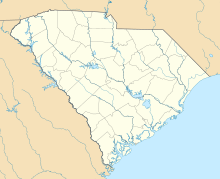
| Location of the Charleston International Airport | |||||||||||||||
| Runways | |||||||||||||||
|
|||||||||||||||
| Statistics (2015) | |||||||||||||||
|
|||||||||||||||
|
Source: Charleston Co. Aviation Authority
|
|||||||||||||||
| Passengers | 3,418,089 |
|---|---|
| Aircraft operations (incl. military) |
105,782 |
Charleston International Airport (IATA: CHS, ICAO: KCHS, FAA LID: CHS) is a joint civil-military airport located in North Charleston, South Carolina. The airport is operated by the Charleston County Aviation Authority under a joint-use agreement with Joint Base Charleston. It is South Carolina's largest and busiest airport; in 2016 the airport served over 3.7 million passengers in its busiest year on record. The airport is located in North Charleston and is approximately 12 miles (20 km) northwest of downtown Charleston. The airport is also home to the Boeing facility that assembles the 787 Dreamliner.
In 1928, the Charleston Airport Corporation was founded and purchased 700 acres of land previously belonging to a mining company. Although privately developed at first, the City of Charleston floated bonds in 1931 to acquire a portion of the site for passenger service. Within ten years, three runways were paved and outfitted with lighting for nighttime operations. In World War II, control of the airfield passed to the United States Army though civilian service was allowed to continue to use the airfield. After the war, the airfield reverted to civilian use for a short time. In 1949, a new passenger terminal was built.
During the Korean War, the airfield was reactivated for military use and in 1952, the City of Charleston and the United States Air Force reached an agreement on control of the base and the runways—an arrangement that has been renegotiated over time and that continues to this day. In 1979, the civilian portions of the airport were transferred from the City of Charleston to the Charleston County Aviation Authority, which had operated two other airports in the area. The current terminal on the south end of the airport was built in the 1980s on land acquired by Georgia Pacific.
...
Wikipedia

