Chapadinha
| Chapadinha | ||
|---|---|---|
| Municipality | ||
|
||
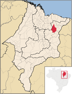
 Location in Maranhão state |
||
| Location in Brazil | ||
| Coordinates: 03°44′31″S 43°21′36″W / 3.74194°S 43.36000°WCoordinates: 03°44′31″S 43°21′36″W / 3.74194°S 43.36000°W | ||
| Country |
|
|
| Region | Northeast Region | |
| State | Maranhão | |
| Area | ||
| • Total | 3,247 km2 (1,254 sq mi) | |
| Population (2015) | ||
| • Total | 77,684 | |
| • Density | 24/km2 (62/sq mi) | |
| Time zone | BRT (UTC-3) | |
Chapadinha is a Brazilian municipality in the state of Maranhão. It is located 235 km south-east of the state capital São Luís. The population is 77,684 (2015) and the total area is 3,247 km2.
The municipality lies in the Munim River basin. The municipality contains the 11,971 hectares (29,580 acres) Chapada Limpa Extractive Reserve, created in 2007.
...
Wikipedia


