Chamberlain, SD
| Chamberlain, South Dakota | |
|---|---|
| City | |

Akta Lakota Museum
|
|
| Motto: "One day just isn't enough..." | |
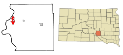
 Location in Brule County and the state of South Dakota |
|
| Coordinates: 43°48′20″N 99°19′42″W / 43.80556°N 99.32833°WCoordinates: 43°48′20″N 99°19′42″W / 43.80556°N 99.32833°W | |
| Country | United States |
| State | South Dakota |
| County | Brule |
| Founded | 1881 |
| Area | |
| • Total | 7.84 sq mi (20.31 km2) |
| • Land | 6.64 sq mi (17.20 km2) |
| • Water | 1.20 sq mi (3.11 km2) |
| Elevation | 1,404 ft (428 m) |
| Population (2010) | |
| • Total | 2,387 |
| • Estimate (2016) | 2,369 |
| • Density | 359.5/sq mi (138.8/km2) |
| Time zone | Central (CST) (UTC-6) |
| • Summer (DST) | CDT (UTC-5) |
| ZIP codes | 57325-57326 |
| Area code(s) | 605 |
| FIPS code | 46-11220 |
| GNIS feature ID | 1265153 |
| Website | http://www.chamberlainsd.org/ |
Chamberlain is a city in Brule County, South Dakota, United States. It is located on the Eastern bank of the Lake Francis Case dammed section of the Missouri river, close to where it is crossed by Interstate 90 highway.
The population of Chamberlain was 2,387 at the 2010 census. It is the county seat of Brule County.
Chamberlain is home to the Saint Joseph's Indian School, which also includes the Akta Lakota Museum and Cultural Center, which profiles the lives of nomadic Plains Indians. Chamberlain is also the home of the South Dakota Hall of Fame.
Chamberlain was named after Selah Chamberlain, a railroad director of the Chicago, Milwaukee and St. Paul Railway.
Chamberlain is located at 43°49′20″N 99°19′42″W / 43.82222°N 99.32833°W (43.805548, -99.328444).
According to the United States Census Bureau, the city has a total area of 7.84 square miles (20.31 km2), of which, 6.64 square miles (17.20 km2) is land and 1.20 square miles (3.11 km2) is water.
Chamberlain has been assigned the ZIP code range 57325-57326 and the FIPS place code 11220.
...
Wikipedia
