Chambéry Airport
|
Chambéry Airport Aéroport de Chambéry – Savoie |
|||||||||||||||
|---|---|---|---|---|---|---|---|---|---|---|---|---|---|---|---|
 |
|||||||||||||||
 |
|||||||||||||||
| Summary | |||||||||||||||
| Airport type | Public | ||||||||||||||
| Owner | Conseil général de la Savoie (100%) | ||||||||||||||
| Operator | Vinci Airports | ||||||||||||||
| Serves | Chambéry, France | ||||||||||||||
| Location | Voglans, La Motte-Servolex, Le Bourget-du-Lac, Viviers-du-Lac | ||||||||||||||
| Hub for |
|
||||||||||||||
| Built | 1938 | ||||||||||||||
| Elevation AMSL | 234 m / 768 ft | ||||||||||||||
| Coordinates | 45°38′24″N 05°52′52″E / 45.64000°N 5.88111°ECoordinates: 45°38′24″N 05°52′52″E / 45.64000°N 5.88111°E | ||||||||||||||
| Website | chambery-airport.com | ||||||||||||||
| Maps | |||||||||||||||
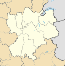
 Location of Rhône-Alpes region in France |
|||||||||||||||
| Location of airport in Rhône-Alpes region | |||||||||||||||
| Runways | |||||||||||||||
|
|||||||||||||||
| Statistics (2015) | |||||||||||||||
|
|||||||||||||||
|
Source: French AIP
|
|||||||||||||||
| Passengers | 215,216 |
|---|---|
| Passenger change 14–15 |
|
| Aircraft movements | 33,597 |
| Movements change 14–15 |
|
Chambéry Airport or Chambéry-Savoie Airport (French: Aéroport de Chambéry-Savoie) (IATA: CMF, ICAO: LFLB), also known as Chambéry Aix-les-Bains Airport, is a small international airport near Chambéry, a commune in Savoie, France. Commercial activities started at the airport in 1960.
The airport resides at an elevation of 234 metres (768 ft) above mean sea level. It has one paved runway designated which measures 2,020 by 45 metres (6,627 ft × 148 ft). It also has a parallel unpaved runway with a grass surface measuring 700 by 60 metres (2,297 ft × 197 ft).
...
Wikipedia

