Chalmette, Louisiana
| Chalmette | |
| Census-designated place | |
|
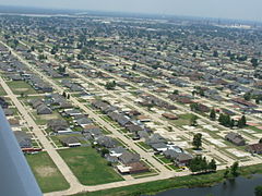
View of Chalmette residential area
|
|
| Country | United States |
|---|---|
| State | Louisiana |
| Parish | St. Bernard |
| Elevation | 3 ft (0.9 m) |
| Coordinates | 29°56′44″N 89°57′42″W / 29.94556°N 89.96167°WCoordinates: 29°56′44″N 89°57′42″W / 29.94556°N 89.96167°W |
| Area | 7.9 sq mi (20.5 km2) |
| - land | 7.3 sq mi (19 km2) |
| - water | 0.6 sq mi (2 km2), 7.59% |
| Population | 17,119 (2011) |
| Density | 1,625/sq mi (627/km2) |
| Timezone | CST (UTC-6) |
| - summer (DST) | CDT (UTC-5) |
| Area code | 504 |
|
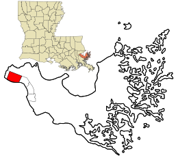
Location in St. Bernard Parish and the state of Louisiana.
|
|
|
Location of Louisiana in the United States
|
|
Chalmette is a census-designated place (CDP) in and the parish seat of St. Bernard Parish, in southeast Louisiana, United States. The 2010 census reported that Chalmette had 16,751 people. The 2011 population is listed as 17,119; however, the pre-Katrina population was 32,069 at the 2000 census. The population hence declined by 46% between 2000 and 2010. Chalmette is part of the New Orleans–Metairie–Kenner Metropolitan Statistical Area. Chalmette is located east of downtown New Orleans and south of Arabi, Louisiana, towards Lake Borgne.
The community was named for Louis-Xavier Martin de Lino de Chalmette (1720-1755), whose surname is, in turn, derived from the French word "chalmette" (meaning "pasture land, fallow land") and has been traced to the Proto-Celtic word "kalm".
Chalmette was founded by plantation owner Louis-Xavier Martin de Lino de Chalmette (1720-1755), a native of Quebec and grandson of René-Louis Chartier de Lotbinière of Maison Lotbinière. His eldest son, Louis Xavier Martin de Lino de Chalmette (1753-1814) was born there and married the sister of Antoine Philippe de Marigny, grandfather of Bernard de Marigny.
...
Wikipedia


