Chaffee, Missouri
| Chaffee, Missouri | |
|---|---|
| City | |
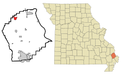
 Location of Chaffee, Missouri |
|
| Coordinates: 37°10′47″N 89°39′34″W / 37.17972°N 89.65944°WCoordinates: 37°10′47″N 89°39′34″W / 37.17972°N 89.65944°W | |
| Country | United States |
| State | Missouri |
| County | Scott |
| Area | |
| • Total | 1.85 sq mi (4.79 km2) |
| • Land | 1.80 sq mi (4.66 km2) |
| • Water | 0.05 sq mi (0.13 km2) |
| Elevation | 344 ft (105 m) |
| Population (2010) | |
| • Total | 2,955 |
| • Estimate (2016) | 2,948 |
| • Density | 1,600/sq mi (620/km2) |
| Time zone | Central (CST) (UTC-6) |
| • Summer (DST) | CDT (UTC-5) |
| ZIP code | 63740 |
| Area code(s) | 573 |
| FIPS code | 29-12988 |
| GNIS feature ID | 0739982 |
Chaffee is a city in Scott County, Missouri, United States. The population was 2,955 at the 2010 census.
Chaffee is located at 37°10′47″N 89°39′34″W / 37.17972°N 89.65944°W (37.179706, -89.659353).
According to the United States Census Bureau, the city has a total area of 1.85 square miles (4.79 km2), of which, 1.80 square miles (4.66 km2) is land and 0.05 square miles (0.13 km2) is water.
As of the census of 2010, there were 2,955 people, 1,204 households, and 762 families residing in the city. The population density was 1,641.7 inhabitants per square mile (633.9/km2). There were 1,336 housing units at an average density of 742.2 per square mile (286.6/km2). The racial makeup of the city was 97.83% White, 0.51% Black or African American, 0.20% Native American, 0.10% Asian, 0.07% from other races, and 1.29% from two or more races. Hispanic or Latino people of any race were 1.25% of the population.
...
Wikipedia
