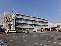
Chūō-ku, Saitama
|
Chūō-ku, Saitama 中央区 |
|
|---|---|
| Ward | |
| Chūō Ward | |

Chūō Ward Office, Saitama City
|
|
 Location of Chūō-ku in Saitama |
|
| Coordinates: 35°53′2.1″N 139°37′34.4″E / 35.883917°N 139.626222°ECoordinates: 35°53′2.1″N 139°37′34.4″E / 35.883917°N 139.626222°E | |
| Country | Japan |
| Region | Kanto |
| Prefecture | Saitama |
| City | Saitama |
| Area | |
| • Total | 8.39 km2 (3.24 sq mi) |
| Population (February 2016) | |
| • Total | 98,881 |
| • Density | 11,790/km2 (30,500/sq mi) |
| Time zone | Japan Standard Time (UTC+9) |
| -Flower | Rose |
| Phone number | 048-856-1111 |
| Address |
5-7-10 Shimoochiai, Chūō-ku, Saitama-shi, Saitama-ken 338-0002 |
| Website | www |
5-7-10 Shimoochiai, Chūō-ku, Saitama-shi, Saitama-ken
Chūō-ku (中央区 lit. "Central ward"?) is one of ten wards of the city of Saitama, in Saitama Prefecture, Japan, and is located in the northern part of the city. As of 1 February 2016[update], the ward had an estimated population of 98,881 and a population density of 11,790 persons per km². Its total area was 8.39 square kilometres (3.24 sq mi). Despite its name, it is not the administrative or the commercial centre of the city, roles which are designated to Urawa-ku and Ōmiya-ku respectively.
Chūō-ku is located to the west of the center of Saitama City, the capital of Saitama Prefecture. Chūō-ku is wedge-shaped with a southern tip. Measuring approximately 5.5 km in the north-south direction and approximately 3.5 km in the east-west direction, it has an area of 8.39 km2. Located on the Kantō Plain, Chūō-ku has a low elevation. Its lowest point, located at Ōto-nichōme, has an elevation of 4.7 m above sea level and its highest point, located at Suzuya-yonchōme, has an elevation of 16.6 m above sea level. The majority of rivers run north-south down the ward, consequently travelling east-west across the ward requires travelling across alternating regions of plateaus and depressions. The eastern-most of these plateaus is the Ōmiya-daichi, to the west of which lies the Kōnuma River which is at the centre of a 500-meter long depression. The Ōmiya-daichi continues to the west of this depression until it meets another depression due to the Arakawa River at the western-most point of the ward.
...
Wikipedia

