Chüebodenhorn
| Chüebodenhorn | |
|---|---|

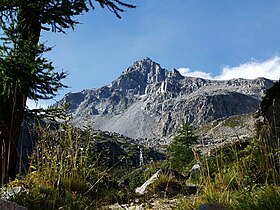
The south side of Chüebodenhorn
|
|
| Highest point | |
| Elevation | 3,070 m (10,070 ft) |
| Prominence | 316 m (1,037 ft) |
| Parent peak | Pizzo Rotondo |
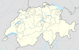
| Coordinates | 46°30′29.2″N 8°27′11.1″E / 46.508111°N 8.453083°ECoordinates: 46°30′29.2″N 8°27′11.1″E / 46.508111°N 8.453083°E |
| Geography | |
| Location | Ticino/Valais, Switzerland |
| Parent range | Lepontine Alps |
The Chüebodenhorn is a 3,070 metres high mountain in the Lepontine Alps, located on the border between the cantons of Valais and Ticino. It is situated south of Passo di Rotondo (2,754 metres), where a glacier named Ghiacciaio del Pizzo Rotondo lies at the foot of its north face. The south side (Ticino) overlooks the valley of Bedretto.
...
Wikipedia

