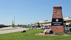
Centennial Airport
| Centennial Airport | |||||||||||||||||||
|---|---|---|---|---|---|---|---|---|---|---|---|---|---|---|---|---|---|---|---|
 |
|||||||||||||||||||
 |
|||||||||||||||||||
| Summary | |||||||||||||||||||
| Airport type | Public | ||||||||||||||||||
| Owner | Arapahoe County Public Airport Authority | ||||||||||||||||||
| Serves | Denver–Aurora Metropolitan Area, Colorado | ||||||||||||||||||
| Location | Dove Valley CDP, Colorado | ||||||||||||||||||
| Elevation AMSL | 5,885 ft / 1,794 m | ||||||||||||||||||
| Coordinates | 39°34′12″N 104°50′58″W / 39.57000°N 104.84944°WCoordinates: 39°34′12″N 104°50′58″W / 39.57000°N 104.84944°W | ||||||||||||||||||
| Website | http://www.centennialairport.com/ | ||||||||||||||||||
| Map | |||||||||||||||||||
| Location of airport in Colorado / United States | |||||||||||||||||||
| Runways | |||||||||||||||||||
|
|||||||||||||||||||
| Statistics (2010) | |||||||||||||||||||
|
|||||||||||||||||||
|
Source: Federal Aviation Administration
|
|||||||||||||||||||
| Aircraft operations | 283,186 |
|---|---|
| Based aircraft | 858 |
Centennial Airport (IATA: APA, ICAO: KAPA, FAA LID: APA) is a public use airport owned by the Arapahoe County Public Airport Authority in the Denver-Aurora metropolitan area, 15 nautical miles (17 mi, 28 km) southeast of downtown Denver, Colorado, USA. Located in Dove Valley, a census designated place in Arapahoe County, the airport’s runways extend into Douglas County.
The airport opened on May 12, 1968 as Arapahoe County Airport, and was renamed on July 13, 1984. The new name reflects Colorado’s admission to the Union as the 38th state in 1876, the centennial of the United States Declaration of Independence.
In 1985 a new control tower was built. It is an international airport with continuous U.S. Customs services and is one of the busiest general aviation airports in the United States with an average of 874 operations per day. The Federal Aviation Administration control tower and associated air traffic control services are continuous; Runway 35R has a Category I Instrument Approach.
...
Wikipedia


