Arapahoe County, Colorado
| Arapahoe County, Colorado | |
|---|---|

Logo
|
|
 Location in the U.S. state of Colorado |
|
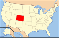
 Colorado's location in the U.S. |
|
| Founded | November 1, 1861 |
| Named for | The Arapaho Nation |
| Seat | Littleton |
| Largest city | Aurora |
| Area | |
| • Total | 805 sq mi (2,085 km2) |
| • Land | 798 sq mi (2,067 km2) |
| • Water | 7.3 sq mi (19 km2), 0.9% |
| Population (est.) | |
| • (2015) | 631,096 |
| • Density | 606/sq mi (234/km²) |
| Congressional districts | 1st, 4th, 6th |
| Time zone | Mountain: UTC-7/-6 |
| Website | www |
|
Footnotes:
|
|
Arapahoe County (/əˈræpəhoʊ/ ə-RAP-ə-ho) is one of the 64 counties in the U.S. state of Colorado. As of the 2010 census, the population was 572,003, making it the third-most populous county in Colorado. The county seat is Littleton, and the most populous city is Aurora. The county was named for the Arapaho Native American tribe who once lived in the region.
Arapahoe County is part of the Denver-Aurora-Lakewood, CO Metropolitan Statistical Area. Arapahoe County calls itself "Colorado's First County" since its origins predate the Pike's Peak Gold Rush.
On August 25, 1855, the Kansas Territorial Legislature created a huge Arapahoe County to govern the entire western portion of the Territory of Kansas. The county was named for the Arapaho Nation who lived in the region.
...
Wikipedia
