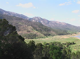
Cazorla Range
| Sierra de Cazorla | |
|---|---|

Landscape in Sierra de Cazorla
|
|
| Highest point | |
| Peak | Gilillo |
| Elevation | 1,847 m (6,060 ft) |
| Coordinates | 37°56′12″N 02°57′30″W / 37.93667°N 2.95833°WCoordinates: 37°56′12″N 02°57′30″W / 37.93667°N 2.95833°W |
| Geography | |
|
|
|
| Country | Spain |
| Parent range | Prebaetic System |
| Geology | |
| Mountain type | Limestone |
| Climbing | |
| Easiest route | From Cazorla |
Sierra de Cazorla is a mountain range of the Prebaetic System in the Jaén Province in Spain. It is named after the town of Cazorla. Its highest point is the 1,847 m high Gilillo peak.
This mountain range is located between the Sierra Nevada, the Sierra de Segura and Sierra del Pozo mountain ranges. The easiest route to reach it is from Cazorla town.
The Santuario de la Virgen de Tíscar is a shrine dedicated to the Virgin Mary located on a mountain pass in Sierra de Cazorla.
...
Wikipedia

