Cascade, Wisconsin
| Cascade, Wisconsin | |
|---|---|
| Village | |

Looking west in downtown Cascade
|
|
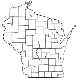
 Location of Cascade, Wisconsin |
|
| Coordinates: 43°39′31″N 88°0′30″W / 43.65861°N 88.00833°WCoordinates: 43°39′31″N 88°0′30″W / 43.65861°N 88.00833°W | |
| Country | United States |
| State | Wisconsin |
| County | Sheboygan |
| Area | |
| • Total | 0.82 sq mi (2.12 km2) |
| • Land | 0.81 sq mi (2.10 km2) |
| • Water | 0.01 sq mi (0.03 km2) |
| Elevation | 869 ft (265 m) |
| Population (2010) | |
| • Total | 709 |
| • Estimate (2012) | 703 |
| • Density | 875.3/sq mi (338.0/km2) |
| Time zone | Central (CST) (UTC-6) |
| • Summer (DST) | CDT (UTC-5) |
| Area code(s) | 920 |
| FIPS code | 55-12825 |
| GNIS feature ID | 1562757 |
Cascade is a village in Sheboygan County, Wisconsin, United States. The population was 709 at the 2010 census. It is included in the Sheboygan, Wisconsin Metropolitan Statistical Area. Wisconsin Highway 28 passes through Cascade.
With the construction of two 100-kilowatt wind turbines in June 2010, Cascade became the first community in Wisconsin to use locally produced wind energy to power its municipal wastewater treatment plant.
Cascade is located at 43°39′31″N 88°0′30″W / 43.65861°N 88.00833°W (43.658541, -88.008412).
According to the United States Census Bureau, the village has a total area of 0.82 square miles (2.12 km2), of which, 0.81 square miles (2.10 km2) of it is land and 0.01 square miles (0.03 km2) is water.
As of the census of 2010, there were 709 people, 274 households, and 206 families residing in the village. The population density was 875.3 inhabitants per square mile (338.0/km2). There were 291 housing units at an average density of 359.3 per square mile (138.7/km2). The racial makeup of the village was 97.7% White, 0.4% African American, 0.3% Native American, 0.4% Pacific Islander, 0.7% from other races, and 0.4% from two or more races. Hispanic or Latino of any race were 3.8% of the population.
...
Wikipedia
