Caruthersville, Missouri
| Caruthersville, Missouri | |
|---|---|
| City | |

Ward Street downtown
|
|
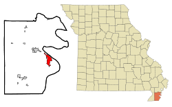
 Location within Pemiscot County and Missouri |
|
| Coordinates: 36°11′5″N 89°39′41″W / 36.18472°N 89.66139°WCoordinates: 36°11′5″N 89°39′41″W / 36.18472°N 89.66139°W | |
| Country | United States |
| State | Missouri |
| County | Pemiscot |
| Area | |
| • Total | 5.24 sq mi (13.57 km2) |
| • Land | 5.16 sq mi (13.36 km2) |
| • Water | 0.08 sq mi (0.21 km2) |
| Elevation | 276 ft (84 m) |
| Population (2010) | |
| • Total | 6,168 |
| • Estimate (2012) | 6,116 |
| • Density | 1,200/sq mi (450/km2) |
| Time zone | Central (CST) (UTC-6) |
| • Summer (DST) | CDT (UTC-5) |
| ZIP code | 63830 |
| Area code(s) | 573 |
| FIPS code | 29-11692 |
| GNIS feature ID | 715460 |
| Website | City Website |
Caruthersville is a city in and the county seat of Pemiscot County, Missouri, United States, located along the Mississippi River in the Bootheel region of the state's far southeast. The population was 6,168, according to the 2010 Census.
Caruthersville lies in Missouri's Bootheel on the Mississippi River. The word "Pemiscot" comes from the word pemiskaw, meaning "liquid mud" in the Fox language. Mississippi waters have frequently flooded the flatlands, creating fertile alluvial land valued for farming. Settling the floodplain has resulted in periodic problems for residents, as there are regular floods despite (and because of) elaborate constructed systems of levees and flood controls.
Native Americans inhabited the land of the Caruthersville area for thousands of years before European settlement. The Mississippian culture built huge earthwork mounds throughout the Mississippi Valley. One such earthwork remains in this county, rising 270 feet above sea level about four miles southwest of Caruthersville. It stands in contrast to the surrounding delta-like plain.
In 1857 John Hardeman Walker and G. W. Bushey laid out and platted the town of Caruthersville. The town was named for Samuel Caruthers, who first represented the area in the US Congress.
The City of Caruthersville was incorporated on May 18, 1874. The first few decades of the town's growth can be documented through Sanborn Maps, which recorded building ownership, materials, and use.
In 1893, Missouri's General Assembly created the Saint Francis Levee District to construct protection for that part of the Saint Francis River basin lying within the counties of Dunklin, New Madrid, and Pemiscot. This act authorized taxes for the purpose of building, repairing, protecting, and maintaining levees in the district.
...
Wikipedia
