Carthage, MO
| Carthage, Missouri | |
|---|---|
| City | |

Stores around the Courthouse square
|
|
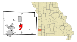
 Location within Jasper County and Missouri |
|
| Coordinates: 37°10′4″N 94°18′54″W / 37.16778°N 94.31500°WCoordinates: 37°10′4″N 94°18′54″W / 37.16778°N 94.31500°W | |
| Country | United States |
| State | Missouri |
| County | Jasper |
| Government | |
| • Type | City Council |
| • Mayor | Mike Harris |
| Area | |
| • Total | 11.69 sq mi (30.28 km2) |
| • Land | 11.65 sq mi (30.17 km2) |
| • Water | 0.04 sq mi (0.10 km2) |
| Elevation | 1,004 ft (306 m) |
| Population (2010) | |
| • Total | 14,502 |
| • Estimate (2016) | 14,309 |
| • Density | 1,200/sq mi (480/km2) |
| Time zone | Central (CST) (UTC-6) |
| • Summer (DST) | CDT (UTC-5) |
| ZIP code | 64836 |
| Area code(s) | 417 |
| FIPS code | 29-11656 |
| GNIS feature ID | 0715455 |
| Website | http://carthagemo.gov/ |
Carthage is a city in Jasper County, Missouri, United States. The population was 14,378 at the 2010 census. It is the county seat of Jasper County and is nicknamed "America's Maple Leaf City."
Jasper County was formed in 1841. Carthage was chosen as the county seat, the area cleared and the town platted in 1842. The city was named after ancient Carthage. By the time of the American Civil War, there were over 500 residents, a brick and stone courthouse, and several businesses.
The area was divided over slavery, and almost all of the African-Americans in the county at the time were slaves. The Battle of Carthage, fought on July 5, 1861, was a clash between Union troops from St. Louis and Confederate troops led by the pro-Southern Missouri Governor, Claiborne Fox Jackson. The "Second Battle of Carthage" occurred in October 1863 when Union troops confronted Confederate troops north of town and forced them to return to Arkansas. The town experienced minor skirmishes and attacks throughout the war; pro-Confederate guerrillas burned most of the city (including the courthouse) in September 1864. Historical accounts, such as Jasper County, Missouri in the Civil War (1923) by Col. Ward L. Schrantz, document the regional warfare.
The area grew rapidly following the Civil War. The Missouri Western Railroad arrived in 1872. Town residents started a foundry, furniture factory, woolen and grain mills, a plow works and numerous liveries and other businesses.Leggett & Platt, now a Fortune 500 company still based in Carthage, was founded in 1883. Nearby lead mines and limestone quarries also contributed significant wealth and Carthage became one of the most prosperous towns in the area. Residents poured their money into ornate Victorian-style homes, many of which are now part of the Carthage South District, which was named to the National Register of Historic Places in 1982. The Jasper County Courthouse, also on the National Register of Historic Places, was built of Carthage stone in 1894-95. There is a mural inside the courthouse depicting the history of Jasper County. Growth in Carthage can be documented through Sanborn Maps, many of which are available online.
...
Wikipedia
