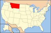
Carter County, MT
| Carter County, Montana | |
|---|---|

Carter County Courthouse in Ekalaka
|
|
 Location in the U.S. state of Montana |
|
 Montana's location in the U.S. |
|
| Founded | 1917 |
| Named for | Thomas H. Carter |
| Seat | Ekalaka |
| Largest town | Ekalaka |
| Area | |
| • Total | 3,348 sq mi (8,671 km2) |
| • Land | 3,341 sq mi (8,653 km2) |
| • Water | 7.5 sq mi (19 km2), 0.2% |
| Population (est.) | |
| • (2017) | 1,222 |
| • Density | 0.4/sq mi (0.2/km2) |
| Congressional district | At-large |
| Time zone | Mountain: UTC−7/−6 |
| Website | www |
Carter County is a county located in the U.S. state of Montana. As of the 2010 census, the population was 1,160, making it the fifth-least populous county in Montana. The county seat is Ekalaka.
Carter County was named for Thomas Henry Carter, the first congressman from Montana. Prior to settlement the land was occupied by the Sioux tribe.
According to the U.S. Census Bureau, the county has a total area of 3,348 square miles (8,670 km2), of which 3,341 square miles (8,650 km2) is land and 7.5 square miles (19 km2) (0.2%) is water.
Medicine Rocks State Park is located 14 miles north of Ekalaka. Weathering has given the rocks an unusual texture. The site was used by Indian hunting parties.
As of the census of 2000, there were 1,360 people, 543 households, and 382 families residing in the county. The population density was <1/km² (<1/sq mi). There were 811 housing units at an average density of <1/km² (<1/sq mi). The racial makeup of the county was 98.60% White, 0.07% Black or African American, 0.37% Native American, 0.15% Asian, 0.29% from other races, and 0.51% from two or more races. 0.59% of the population were Hispanic or Latino of any race. 35.3% were of German, 14.0% English, 12.9% Norwegian, 11.1% Irish and 5.2% Scottish ancestry.
...
Wikipedia
